Area Overview for NN12 8FF
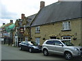
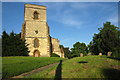
Photos of NN12 8FF


Area Information
NN12 8FF represents a specific residential cluster in England with a compact footprint of ten hectares. The community consists of 1791 residents spread across this small area, creating a population density of 112 people per square kilometre. You will find a quiet environment where houses dominate the landscape rather than high-rise blocks. This postcode serves as a distinct residential pocket within the wider NN12 region, offering a settled atmosphere for those seeking a home. The layout supports a suburban lifestyle where neighbours are close enough to know one another but maintain a degree of privacy. Daily life here revolves around local streets and practical access to nearby towns. With a total population under 2000, the area avoids the congestion often associated with larger urban settlements. Instead, you gain access to a neighbourhood that feels established and calm. The small size ensures that services remain within a manageable distance for daily errands. This specific cluster caters to families and individuals who value a lower density living arrangement without sacrificing essential access to greater amenities located just beyond its boundaries.
- Area Type
- Postcode
- Area Size
- 10.0 hectares
- Population
- 1791
- Population Density
- 112 people/km²
Living in NN12 8FF means entering a market defined by private residence rather than rental accommodation. The data shows that 78% of households own their homes, creating a strong environment for buyers looking to purchase. This high ownership rate indicates that the area is not primarily a student let or short-term rental hub. Instead, the market consists of established family homes and owner-occupied dwellings. The accommodation type is exclusively houses, meaning you will not find flats or apartments within this specific postcode boundary. If you are searching for homes in NN12 8FF, you are looking for standalone properties or semi-detached houses suitable for families or retired adults. The lack of rental properties suggests a stable market where owners have committed to the locality. This concentration of house ownership often leads to a consistent building style and garden space across the streets. Buyers seeking to extend or modify their property will find fewer restrictions associated with high-density blocks. The market here rewards those who wish to settle permanently, as the infrastructure supports long-term family life rather than transient living arrangements.
House Prices in NN12 8FF
Showing 2 properties
| Address | Type | Beds | Baths | Last Sale Price | Last Sale Date | |
|---|---|---|---|---|---|---|
| The New Farmhouse, Pound Lane, Eastcote, NN12 8FF | house | - | - | - | - | |
| Eastcote House, Pound Lane, Eastcote, NN12 8FF | house | - | - | - | - |
Energy Efficiency in NN12 8FF
Your daily life in NN12 8FF is supported by a practical range of amenities located within easy reach. Five retail outlets serve the local shopping needs, providing convenience for groceries and everyday purchases. Notable among these are Tesco Towcester and Aldi Towcester, both situated near the area to facilitate weekly shopping. Spar - M1 Northbound also serves residents requiring quick fuel or essentials while travelling or living nearby. Public transport links connect you to Northampton Railway Station and the Northampton Bus Interchange, offering straightforward access to broader regional routes. This combination of supermarkets and transport hubs creates a efficient routine for visitors and locals alike. While the data does not list restaurants, bars, or specific parks within the immediate cluster, the presence of major chain supermarkets suggests access to varied food options. The location allows you to run errands without travelling far, utilising the five available retail points. Living in NN12 8FF means having your essential services within a short drive or walk to the designated towns. The reliance on Tesco and Aldi indicates a focus on value and practicality in the local retail landscape. You gain the benefit of established high-street brands without the need for extensive travel to city centres.
Amenities
Schools
Families living in NN12 8FF have access to a specific selection of educational institutions located nearby. Pattishall Church of England Primary School operates as a primary school with a good Ofsted rating. Tiffield Church of England Voluntary Aided Primary School also functions as a primary option and holds a good Ofsted rating. These two institutions offer state-recognised education for younger children in the locality. For alternative needs, The Gateway School provides special education services to the community. The Gateway School stands as the designated special school within the immediate vicinity. Additionally, Tiffield - St John's operates as an other type of school, potentially serving diverse educational purposes. Barbara Kahan Centre also serves the area under an other classification. This mix ensures that residents can find primary education with proven quality standards alongside specialist provisions. The presence of schools with good ratings like Pattishall and Tiffield Voluntary Aided provides reassurance for parents choosing schools near NN12 8FF. You do not have data on secondary institutions within the immediate cluster, limiting the scope to primary and special education options listed. The proximity of these specific schools makes the neighbourhood a viable option for families seeking primary education for their children.
| Rank | School | Type | Entry gender | Ages |
|---|
Explore more schools in this area
Go to Schools tabDemographics
The community in NN12 8FF reflects a stable and mature population structure. The median age stands at 47 years, indicating that the most common age range comprises adults between 30 and 64 years of age. This demographic profile suggests an area settled by households that have likely established roots in the neighbourhood. Home ownership is the prevailing condition, with 78% of residents owning their properties outright or via mortgage. The remaining minority rent their accommodation, highlighting a strong sense of local investment. Almost exclusively, the housing stock consists of houses, which aligns with the ownership statistics. The predominant ethnic group in the area is White, mirroring the broader regional composition typical of established English suburbs. This demographic makeup contributes to a consistent community character where long-term residents form the majority. The high rate of home ownership points to a population focused on stability rather than transient renting. You will find fewer young children in the broader age mix compared to family-centric estates, though the 30-64 age bracket ensures a steady workforce and active adults within the community. The area does not indicate significant diversity statistics beyond the predominant white population, suggesting a traditional settlement pattern.
Household Size
Accommodation Type
Tenure
Ethnic Group
Religion
Household Composition
Age
Household Deprivation
NS-SEC
Explore more demographic insights in this area
Go to Demographics tabPlanning
Planning Constraints
- Flood RiskPremium
- Ramsar Wetland SitesPremium
- Area of Outstanding Natural BeautyPremium
- Protected Nature ReservePremium
- Protected WoodlandPremium