Area Overview for NN12 8AY
Photos of NN12 8AY
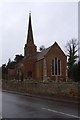
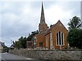
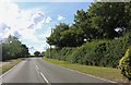
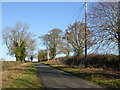
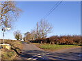
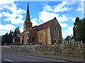
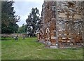
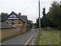
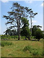
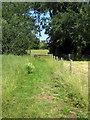
18 photos from this area
Area Information
Key information about the NN12 8AY including its size, population, and administrative classification.
- Area Type
- Postcode
- Area Size
- 1.7 hectares
- Population
- 1827
- Population Density
- 133 people/km²
House Prices in NN12 8AY
41
Properties
£347,996
Average Sold Price
£105,000
Lowest Price
£675,000
Highest Price
Showing 41 properties
| Address | Type | Beds | Baths | Last Sale Price | Last Sale Date | |
|---|---|---|---|---|---|---|
| Orchard House, 54 Home Close, Greens Norton, NN12 8AY | Detached | 4 | 2 | £675,000 | Aug 2025 | |
| 7 Home Close, Greens Norton, NN12 8AY | house | - | - | £366,500 | Sep 2022 | |
| Cherry Tree, 48 Home Close, Greens Norton, NN12 8AY | Detached | 4 | - | £535,000 | Sep 2020 | |
| Carroty Wood, 6 Home Close, Greens Norton, NN12 8AY | Detached | 3 | 2 | £312,500 | Apr 2019 | |
| 21 Home Close, Greens Norton, NN12 8AY | Detached | 5 | 2 | £355,000 | Jul 2018 | |
| 56 Home Close, Greens Norton, NN12 8AY | house | - | - | £575,000 | Mar 2017 | |
| 11 Home Close, Greens Norton, NN12 8AY | Detached | 4 | 1 | £267,000 | Oct 2013 | |
| 15 Home Close, Greens Norton, NN12 8AY | house | - | - | £240,000 | Aug 2010 | |
| 2 Home Close, Greens Norton, NN12 8AY | house | - | - | £250,000 | Oct 2009 | |
| 19 Home Close, Greens Norton, NN12 8AY | Detached | - | - | £299,950 | Mar 2008 |
Page 1 of 5
Energy Efficiency in NN12 8AY
Amenities
Schools
| Rank | School | Type | Entry gender | Ages |
|---|
Explore more schools in this area
Go to Schools tabDemographics
Household Size
Two person
most common
Accommodation Type
Houses
most common
Tenure
73
majority
Ethnic Group
White
most common
Religion
N/A
most common
Household Composition
N/A
most common
Age
47
median
Adults (30-64 years)
most common
Household Deprivation
N/A
with no deprivation
NS-SEC
44
in Lower managerial occupations
Explore more demographic insights in this area
Go to Demographics tabPlanning
Planning Constraints
- Flood RiskPremium
- Ramsar Wetland SitesPremium
- Area of Outstanding Natural BeautyPremium
- Protected Nature ReservePremium
- Protected WoodlandPremium