Area Overview for NN12 7RU
Photos of NN12 7RU
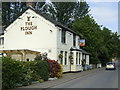
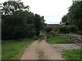
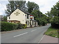
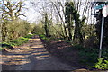
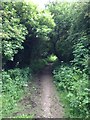
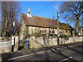
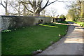
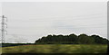
9 photos from this area
Area Information
Key information about the NN12 7RU including its size, population, and administrative classification.
- Area Type
- Postcode
- Area Size
- 69.1 hectares
- Population
- 1840
- Population Density
- 80 people/km²
House Prices in NN12 7RU
33
Properties
£509,882
Average Sold Price
£52,000
Lowest Price
£1,330,000
Highest Price
Showing 33 properties
| Address | Type | Beds | Baths | Last Sale Price | Last Sale Date | |
|---|---|---|---|---|---|---|
| Dovecote House, Main Road, Shutlanger, NN12 7RU | Detached | 4 | 4 | £1,182,500 | Mar 2024 | |
| The Granary, Main Road, Shutlanger, NN12 7RU | house | - | - | £1,330,000 | Dec 2023 | |
| 67 Main Road, Shutlanger, NN12 7RU | house | - | - | £260,000 | Jan 2023 | |
| 65 Main Road, Shutlanger, NN12 7RU | Terraced | 2 | - | £301,000 | Jun 2021 | |
| Sycamore Cottage, 6 Main Road, Shutlanger, NN12 7RU | Detached | 5 | 2 | £790,000 | Feb 2021 | |
| 29 Main Road, Shutlanger, NN12 7RU | house | - | - | £430,000 | May 2019 | |
| Volante, 21 Main Road, Shutlanger, NN12 7RU | Detached | 4 | - | £400,000 | Nov 2013 | |
| 61 Main Road, Shutlanger, NN12 7RU | Semi-detached | 2 | 1 | £151,500 | Oct 2012 | |
| The Cottage, 33 Main Road, Shutlanger, NN12 7RU | house | - | - | £331,000 | Jul 2010 | |
| Brookbank House, 9 Main Road, Shutlanger, NN12 7RU | house | 5 | 5 | £975,000 | May 2010 |
Page 1 of 4
Energy Efficiency in NN12 7RU
Amenities
Schools
| Rank | School | Type | Entry gender | Ages |
|---|
Explore more schools in this area
Go to Schools tabDemographics
Household Size
Two person
most common
Accommodation Type
Houses
most common
Tenure
76
majority
Ethnic Group
White
most common
Religion
N/A
most common
Household Composition
N/A
most common
Age
47
median
Adults (30-64 years)
most common
Household Deprivation
N/A
with no deprivation
NS-SEC
45
in Lower managerial occupations
Explore more demographic insights in this area
Go to Demographics tabPlanning
Planning Constraints
- Flood RiskPremium
- Ramsar Wetland SitesPremium
- Area of Outstanding Natural BeautyPremium
- Protected Nature ReservePremium
- Protected WoodlandPremium