Area Overview for NN12 7PX
Photos of NN12 7PX
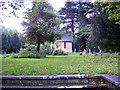
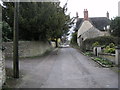

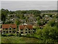
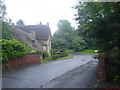
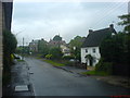
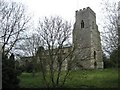
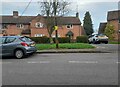
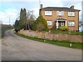
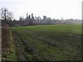
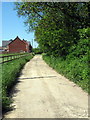
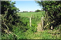
17 photos from this area
Area Information
Key information about the NN12 7PX including its size, population, and administrative classification.
- Area Type
- Postcode
- Area Size
- 14.3 hectares
- Population
- 2208
- Population Density
- 98 people/km²
House Prices in NN12 7PX
39
Properties
£458,672
Average Sold Price
£150,000
Lowest Price
£1,250,000
Highest Price
Showing 39 properties
| Address | Type | Beds | Baths | Last Sale Price | Last Sale Date | |
|---|---|---|---|---|---|---|
| 25 Church End, Potterspury, NN12 7PX | house | 4 | 3 | £620,000 | Jul 2024 | |
| 14 Church End, Potterspury, NN12 7PX | Retail | 3 | 1 | £295,000 | Oct 2022 | |
| 10 Church End, Potterspury, NN12 7PX | Retail | 3 | 1 | £330,000 | Aug 2022 | |
| 12 Church End, Potterspury, NN12 7PX | Retail | 4 | 2 | £350,000 | Aug 2022 | |
| 6 Church End, Potterspury, NN12 7PX | Detached | 4 | 2 | £635,000 | Sep 2021 | |
| 20 Church End, Potterspury, NN12 7PX | house | - | - | £250,000 | Dec 2020 | |
| 4 Church End, Potterspury, NN12 7PX | house | - | - | £475,000 | Oct 2020 | |
| 30 Church End, Potterspury, NN12 7PX | Terraced | 3 | 2 | £245,000 | Jul 2020 | |
| Grafton House, 11 Church End, Potterspury, NN12 7PX | Semi-detached | - | - | £515,000 | Dec 2019 | |
| The Old Vicarage, 8 Church End, Potterspury, NN12 7PX | Detached | 5 | 4 | £1,250,000 | Jun 2019 |
Page 1 of 4
Energy Efficiency in NN12 7PX
Amenities
Schools
| Rank | School | Type | Entry gender | Ages |
|---|
Explore more schools in this area
Go to Schools tabDemographics
Household Size
Two person
most common
Accommodation Type
Houses
most common
Tenure
77
majority
Ethnic Group
White
most common
Religion
N/A
most common
Household Composition
N/A
most common
Age
47
median
Adults (30-64 years)
most common
Household Deprivation
N/A
with no deprivation
NS-SEC
41
in Lower managerial occupations
Explore more demographic insights in this area
Go to Demographics tabPlanning
Planning Constraints
- Flood RiskPremium
- Ramsar Wetland SitesPremium
- Area of Outstanding Natural BeautyPremium
- Protected Nature ReservePremium
- Protected WoodlandPremium