Area Overview for NN12 7PR
Photos of NN12 7PR
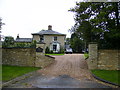
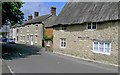
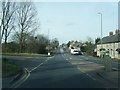
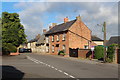

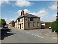
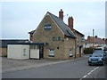
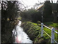
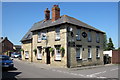
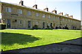
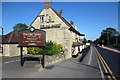
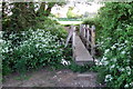
16 photos from this area
Area Information
Key information about the NN12 7PR including its size, population, and administrative classification.
- Area Type
- Postcode
- Area Size
- 2.2 hectares
- Population
- 2208
- Population Density
- 98 people/km²
House Prices in NN12 7PR
46
Properties
£221,344
Average Sold Price
£75,000
Lowest Price
£360,000
Highest Price
Showing 46 properties
| Address | Type | Beds | Baths | Last Sale Price | Last Sale Date | |
|---|---|---|---|---|---|---|
| 127 Mays Way, Potterspury, NN12 7PR | Semi-detached | 2 | 1 | £300,000 | Oct 2023 | |
| 143 Mays Way, Potterspury, NN12 7PR | house | - | - | £255,000 | Sep 2023 | |
| 62 Mays Way, Potterspury, NN12 7PR | house | - | - | £325,000 | Jan 2023 | |
| 115 Mays Way, Potterspury, NN12 7PR | Retail | 3 | 1 | £315,000 | Oct 2022 | |
| 46 Mays Way, Potterspury, NN12 7PR | house | - | - | £360,000 | Sep 2021 | |
| 101 Mays Way, Potterspury, NN12 7PR | house | - | - | £325,000 | Jan 2021 | |
| 109 Mays Way, Potterspury, NN12 7PR | Detached | 2 | 1 | £276,000 | Nov 2020 | |
| 56 Mays Way, Potterspury, NN12 7PR | Detached | 4 | 1 | £315,000 | Sep 2019 | |
| 50 Mays Way, Potterspury, NN12 7PR | house | - | - | £265,000 | Jan 2019 | |
| 105 Mays Way, Potterspury, NN12 7PR | Semi-detached | 2 | 1 | £252,500 | Apr 2018 |
Page 1 of 5
Energy Efficiency in NN12 7PR
Amenities
Schools
| Rank | School | Type | Entry gender | Ages |
|---|
Explore more schools in this area
Go to Schools tabDemographics
Household Size
Two person
most common
Accommodation Type
Houses
most common
Tenure
77
majority
Ethnic Group
White
most common
Religion
N/A
most common
Household Composition
N/A
most common
Age
47
median
Adults (30-64 years)
most common
Household Deprivation
N/A
with no deprivation
NS-SEC
41
in Lower managerial occupations
Explore more demographic insights in this area
Go to Demographics tabPlanning
Planning Constraints
- Flood RiskPremium
- Ramsar Wetland SitesPremium
- Area of Outstanding Natural BeautyPremium
- Protected Nature ReservePremium
- Protected WoodlandPremium