Area Overview for NN12 7NS
Photos of NN12 7NS
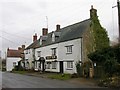
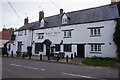


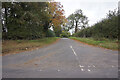
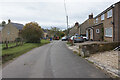
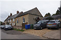

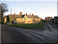
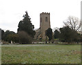
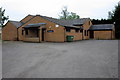
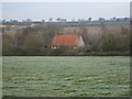
14 photos from this area
Area Information
Key information about the NN12 7NS including its size, population, and administrative classification.
- Area Type
- Postcode
- Area Size
- 19.8 hectares
- Population
- 1840
- Population Density
- 80 people/km²
House Prices in NN12 7NS
30
Properties
£408,957
Average Sold Price
£165,000
Lowest Price
£933,000
Highest Price
Showing 30 properties
| Address | Type | Beds | Baths | Last Sale Price | Last Sale Date | |
|---|---|---|---|---|---|---|
| Farthing Cottage, 41 Lower Street, Pury End, NN12 7NS | Cottage | 3 | 1 | £340,000 | Jul 2025 | |
| Brambletye, Lower Street, Pury End, NN12 7NS | house | 4 | 2 | £595,000 | Oct 2024 | |
| The Barn, Lower Street, Pury End, NN12 7NS | house | 2 | 2 | £370,000 | Mar 2024 | |
| Robins Cottage, 13 Lower Street, Pury End, NN12 7NS | house | 2 | 1 | £410,000 | Nov 2023 | |
| Hafod, Lower Street, Pury End, NN12 7NS | house | - | - | £525,000 | Feb 2022 | |
| 31 Lower Street, Pury End, NN12 7NS | house | - | - | £450,000 | Apr 2021 | |
| Cedar House, Lower Street, Pury End, NN12 7NS | Detached | - | - | £480,000 | Dec 2020 | |
| Lower Cottage, 8 Lower Street, Pury End, NN12 7NS | house | - | - | £933,000 | Jul 2019 | |
| Leigh Cottage, 9 Lower Street, Pury End, NN12 7NS | house | - | - | £652,729 | Aug 2018 | |
| 1 Lower Street, Pury End, NN12 7NS | Semi-detached | - | - | £350,000 | Dec 2017 |
Page 1 of 3
Energy Efficiency in NN12 7NS
Amenities
Schools
| Rank | School | Type | Entry gender | Ages |
|---|
Explore more schools in this area
Go to Schools tabDemographics
Household Size
Two person
most common
Accommodation Type
Houses
most common
Tenure
76
majority
Ethnic Group
White
most common
Religion
N/A
most common
Household Composition
N/A
most common
Age
47
median
Adults (30-64 years)
most common
Household Deprivation
N/A
with no deprivation
NS-SEC
45
in Lower managerial occupations
Explore more demographic insights in this area
Go to Demographics tabPlanning
Planning Constraints
- Flood RiskPremium
- Ramsar Wetland SitesPremium
- Area of Outstanding Natural BeautyPremium
- Protected Nature ReservePremium
- Protected WoodlandPremium