Area Overview for NN12 6YY
Photos of NN12 6YY
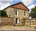

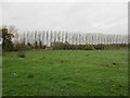
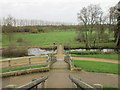

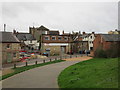
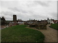

100 photos from this area
Area Information
Key information about the NN12 6YY including its size, population, and administrative classification.
- Area Type
- Postcode
- Area Size
- 11.5 hectares
- Population
- 2189
- Population Density
- 2243 people/km²
House Prices in NN12 6YY
15
Properties
£390,357
Average Sold Price
£270,000
Lowest Price
£820,000
Highest Price
Showing 15 properties
| Address | Type | Beds | Baths | Last Sale Price | Last Sale Date | |
|---|---|---|---|---|---|---|
| 4 Chantry Lane, Towcester, NN12 6YY | Bungalow | - | - | £270,000 | May 2024 | |
| 5 Chantry Lane, Towcester, NN12 6YY | house | - | - | £820,000 | May 2022 | |
| 7 Chantry Lane, Towcester, NN12 6YY | house | - | - | £395,000 | Mar 2020 | |
| 6 Chantry Lane, Towcester, NN12 6YY | Bungalow | - | - | £355,000 | Dec 2019 | |
| 1 Chantry Lane, Towcester, NN12 6YY | house | - | - | £275,000 | Mar 2018 | |
| 3 Chantry Lane, Towcester, NN12 6YY | house | - | - | £345,000 | Mar 2018 | |
| 2 Chantry Lane, Towcester, NN12 6YY | house | - | - | £272,500 | Mar 2018 | |
| Towcester Mill Brewery, Second Floor, Towcester Mill, Chantry Lane, Towcester, NN12 6YY | Office | - | - | - | - | |
| Towcester Mill Brewery, First Floor, Towcester Mill, Chantry Lane, Towcester, NN12 6YY | pub | - | - | - | - | |
| Craftis Ltd, Third Floor, Towcester Mill, Chantry Lane, Towcester, NN12 6YY | Office | - | - | - | - |
Page 1 of 2
Energy Efficiency in NN12 6YY
Amenities
Schools
| Rank | School | Type | Entry gender | Ages |
|---|
Explore more schools in this area
Go to Schools tabDemographics
Household Size
One person
most common
Accommodation Type
Houses
most common
Tenure
66
majority
Ethnic Group
White
most common
Religion
N/A
most common
Household Composition
N/A
most common
Age
47
median
Adults (30-64 years)
most common
Household Deprivation
N/A
with no deprivation
NS-SEC
44
in Lower managerial occupations
Explore more demographic insights in this area
Go to Demographics tabPlanning
Planning Constraints
- Flood RiskPremium
- Ramsar Wetland SitesPremium
- Area of Outstanding Natural BeautyPremium
- Protected Nature ReservePremium
- Protected WoodlandPremium