Area Overview for NN11 8NT
Photos of NN11 8NT


Area Information
Living in NN11 8NT means choosing a small residential cluster defined by specific boundaries rather than a sprawling town centre. This postcode covers 37.9 hectares and houses 1,646 residents, creating a density of 921 people per square kilometre. The area feels intimate because the population is concentrated within a limited footprint. Daily life revolves around immediate access to local services while maintaining a distinct separation from the wider region. Residents enjoy the convenience of a defined neighbourhood where the scale of development remains manageable. The area functions as a quiet, self-contained district where the pace of life is generally slower than in larger towns. You move through streets where the focus remains on living rather than through-traffic. This compact size ensures that essentials are within easy reach without the need for extensive travel. The community benefits from a clear identity shaped by its specific postcode boundaries. When you consider homes in NN11 8NT, you are entering a zone where local familiarity is high and the physical environment is well understood. The area offers a straightforward living experience without complex planning constraints or major geographical barriers. Your day-to-day routine will depend on the proximity of nearby transport links and the specific layout of this residential zone. The small size of the area means you cannot get lost, and everyone is largely within sight of one another. This makes NN11 8NT a practical choice for those who prefer a smaller, more focused settlement.
- Area Type
- Postcode
- Area Size
- 37.9 hectares
- Population
- 1646
- Population Density
- 921 people/km²
The housing stock in NN11 8NT is primarily made up of houses, with no flats or apartments listed in the current data. This type of accommodation suits families and those seeking single-storey or spacious living arrangements. The area is a strong owner-occupied zone, with 41% of households holding their property free of mortgage. This statistic indicates that the market is dominated by long-term residents who have invested in their homes. Buying a home here often means purchasing from someone who has lived there for years, rather than a first-time investor flipping quickly. The concentration of house ownership creates a community with deep local ties and a slower turnover rate. When looking at homes in NN11 8NT, you are likely to encounter stock that has evolved over decades rather than new builds. The area is not a rental-heavy zone, meaning tenants are a smaller portion of the total population. This balance supports a stable local economy where services cater to owner-occupiers with long-term needs. The lack of listed flats suggests limited options for those specifically seeking apartment living within this exact postcode. Buyers should focus on traditional house features that match the predominant accommodation type. The high ownership rate means maintenance standards are generally high as residents take pride in their properties. This environment reduces the vacancy rate and keeps neighbourhoods consistently occupied. For first-time buyers, the 41% ownership figure represents a significant, though not universal, path to entry. The property market operates on local demand and the specific characteristics of the houses available in this cluster. Understanding that this is a house-dominant area helps you narrow your search effectively.
House Prices in NN11 8NT
Showing 3 properties
| Address | Type | Beds | Baths | Last Sale Price | Last Sale Date | |
|---|---|---|---|---|---|---|
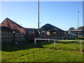
| Cooling Tower 1, Ford Motor Company Ltd, Royal Oak Way South, Daventry, NN11 8NT | Industrial | - | - | - | - | |
| Cooling Tower 2, Ford Motor Company Ltd, Royal Oak Way South, Daventry, NN11 8NT | Industrial | - | - | - | - | |
| Oep Energy Centre Limited, Ford Motor Company Ltd, Royal Oak Way South, Daventry, NN11 8NT | Industrial | - | - | - | - |
Energy Efficiency in NN11 8NT
Residents of NN11 8NT benefit from a selection of retail and transport amenities within practical reach. Five retail locations serve the community, including Morrisons Daily, Co-op Ashby, and Heron Daventry. These venues provide everyday essentials and create a convenient shopping experience for local shoppers. The presence of a supermarket at Morrisons Daily means you can buy fresh food without driving far. Co-op Ashby offers another option for groceries, while Heron Daventry likely provides additional shopping or convenience items. This variety ensures you have access to daily necessities without relying on large regional centres. One railway station, Long Buckby Railway Station, is located nearby for regional travel and commuting. This rail link connects residents to wider transport networks for work or leisure trips. The proximity of these transport hubs enhances the practicality of living in this small residential cluster. You can combine the quiet of NN11 8NT with the connectivity of a rail station just outside your doorstep. The local shops and the nearby station create a balanced lifestyle that avoids isolation. Retail options like Morrisons Daily and Co-op Ashby mean you rarely need to travel far for basic needs. The railway connection to Long Buckby adds a layer of mobility that might otherwise be missing in such a small area. This combination of shops and rail support daily routines effectively for families and workers alike. The amenities listed ensure that convenience remains a priority without sacrificing the residential character of the postcode. Your day-to-day life improves with these specific services available for immediate use.
Amenities
Schools
Families in NN11 8NT rely on nearby educational institutions for their children's schooling. The area is well supported by Daventry Grange Infant School, which serves the early years of primary education. The Grange School, Daventry also features as a primary option for younger children living in the neighbourhood. Both schools operate at the primary level, providing foundational education before students move to secondary institutions outside the immediate list. This mix of primary schools indicates that the local community supports young families with children aged four to eleven. You will find that these schools are likely within walking or short driving distance of NN11 8NT, facilitating daily attendance. The presence of two named primary schools suggests a established educational infrastructure for this postcode area. When you consider schools near NN11 8NT, these specific names appear as the most direct options for local residents. The data does not list secondary schools or OFSTED ratings, so you must look outside the immediate vicinity for older children. However, the availability of primary schools supports the demographic profile of adults aged 30 to 64 who are often raising children. The schools listed reflect a traditional local education model rather than specialist or boarding facilities. Families should plan their routes around Daventry Grange Infant School or The Grange School, Daventry, to ensure convenience. These institutions anchor the community for younger generations and sustain the local population base.
| Rank | School | Type | Entry gender | Ages |
|---|
Explore more schools in this area
Go to Schools tabDemographics
The community in NN11 8NT reflects a mature population structure with a median age of 47 years. Most residents fall into the adult age range of 30 to 64 years, indicating a quarter-life that has been settled for some time. This demographic profile suggests a family-oriented or established singles market rather than a youthful entry-level zone. Accommodation types consist predominantly of houses, which aligns with the needs of the age group present. Fourty-one per cent of households own their properties, showing a significant portion of the community has financial stability and long-term roots. The remaining households rent, indicating a mixed market where new entrants can still find options. The predominant ethnic group is White, which characterises the cultural background of the majority of locals. When living in NN11 8NT, you join a neighbourhood where people have likely grown older in place rather than being recent migrants. The age distribution implies fewer teenagers and young children compared to student hubs or retirement villages. The 47-year median age means local shops serve a demographic comfortable with traditional services rather than high-energy youth trends. This stability provides a predictable environment for families seeking quiet surroundings. The lack of a very young population means the area avoids the noise and hustle associated with primary school zones during peak hours. You will find a community built on shared experience and local knowledge passed down through generations. The demographic data confirms that this is a place for those who value stability over rapid change.
Household Size
Accommodation Type
Tenure
Ethnic Group
Religion
Household Composition
Age
Household Deprivation
NS-SEC
Explore more demographic insights in this area
Go to Demographics tabPlanning
Planning Constraints
- Flood RiskPremium
- Ramsar Wetland SitesPremium
- Area of Outstanding Natural BeautyPremium
- Protected Nature ReservePremium
- Protected WoodlandPremium