Area Overview for NN11 7HS
Photos of NN11 7HS
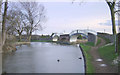
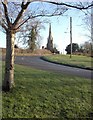
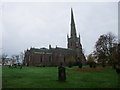
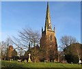
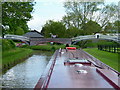
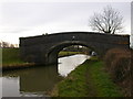
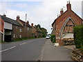
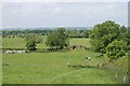
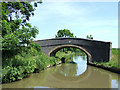
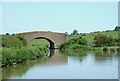
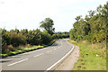
100 photos from this area
Area Information
Key information about the NN11 7HS including its size, population, and administrative classification.
- Area Type
- Postcode
- Area Size
- 16.2 hectares
- Population
- 1820
- Population Density
- 138 people/km²
House Prices in NN11 7HS
49
Properties
£435,427
Average Sold Price
£98,000
Lowest Price
£1,450,000
Highest Price
Showing 49 properties
| Address | Type | Beds | Baths | Last Sale Price | Last Sale Date | |
|---|---|---|---|---|---|---|
| Checkley Close, 69 High Street, Braunston, NN11 7HS | Detached | 4 | 2 | £1,000,000 | Jan 2024 | |
| 76 High Street, Braunston, NN11 7HS | Semi-detached | 1 | 1 | £205,000 | Jul 2023 | |
| 3, Chapel Court, High Street, Braunston, NN11 7HS | Semi-detached | 3 | 2 | £325,000 | May 2022 | |
| Stone House, 104 High Street, Braunston, NN11 7HS | Detached | 5 | 2 | £750,000 | Nov 2021 | |
| Enfield House, 96 High Street, Braunston, NN11 7HS | Semi-detached | 3 | 2 | £275,000 | Jun 2021 | |
| Langdon House, 59 High Street, Braunston, NN11 7HS | Semi-detached | 5 | 2 | £480,000 | Dec 2020 | |
| The Shambles, 53 High Street, Braunston, NN11 7HS | Detached | 5 | 3 | £640,000 | Mar 2020 | |
| The Old Doctors House, 63 High Street, Braunston, NN11 7HS | Detached | 4 | 4 | £575,000 | Aug 2019 | |
| The Hollies, 92 High Street, Braunston, NN11 7HS | Cottage | 4 | 2 | £425,000 | Aug 2019 | |
| 55 High Street, Braunston, NN11 7HS | house | 3 | 1 | £250,000 | Aug 2019 |
Page 1 of 5
Energy Efficiency in NN11 7HS
Amenities
Schools
| Rank | School | Type | Entry gender | Ages |
|---|
Explore more schools in this area
Go to Schools tabDemographics
Household Size
Two person
most common
Accommodation Type
Houses
most common
Tenure
73
majority
Ethnic Group
White
most common
Religion
N/A
most common
Household Composition
N/A
most common
Age
47
median
Adults (30-64 years)
most common
Household Deprivation
N/A
with no deprivation
NS-SEC
39
in Lower managerial occupations
Explore more demographic insights in this area
Go to Demographics tabPlanning
Planning Constraints
- Flood RiskPremium
- Ramsar Wetland SitesPremium
- Area of Outstanding Natural BeautyPremium
- Protected Nature ReservePremium
- Protected WoodlandPremium