Area Overview for NN11 6DE
Photos of NN11 6DE
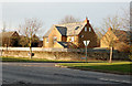
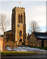
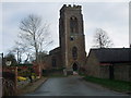
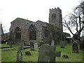
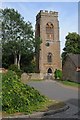
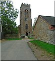
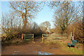
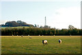
41 photos from this area
Area Information
Key information about the NN11 6DE including its size, population, and administrative classification.
- Area Type
- Postcode
- Area Size
- 15.5 hectares
- Population
- 2068
- Population Density
- 52 people/km²
House Prices in NN11 6DE
20
Properties
£462,250
Average Sold Price
£250,000
Lowest Price
£875,000
Highest Price
Showing 20 properties
| Address | Type | Beds | Baths | Last Sale Price | Last Sale Date | |
|---|---|---|---|---|---|---|
| Godwyn House, Badby Lane, Staverton, NN11 6DE | house | - | - | £250,000 | Jun 2021 | |
| Arbury House, Badby Lane, Staverton, NN11 6DE | house | - | - | £275,000 | Jul 2019 | |
| Southfield, Badby Lane, Staverton, NN11 6DE | Bungalow | 2 | 3 | £449,000 | Nov 2018 | |
| Whitmill Cottage, Badby Lane, Staverton, NN11 6DE | Detached | 4 | 4 | £875,000 | Jun 2014 | |
| New House, Badby Lane, Staverton, NN11 6DE | Detached | 4 | 3 | - | - | |
| Greenfield House, Badby Lane, Staverton, NN11 6DE | Detached | 5 | 3 | - | - | |
| Whitmill Hill Farm, Badby Lane, Staverton, NN11 6DE | Detached | - | - | - | - | |
| Mortain Cottage, Whitmill Hill Farm, Badby Lane, Staverton, NN11 6DE | Detached | - | - | - | - | |
| J A Hall Garden Machinery, Badby Lane, Staverton, NN11 6DE | shop | - | - | - | - | |
| Hillside House, Badby Lane, Staverton, NN11 6DE | house | - | - | - | - |
Page 1 of 2
Energy Efficiency in NN11 6DE
Amenities
Schools
| Rank | School | Type | Entry gender | Ages |
|---|
Explore more schools in this area
Go to Schools tabDemographics
Household Size
Two person
most common
Accommodation Type
Houses
most common
Tenure
82
majority
Ethnic Group
White
most common
Religion
N/A
most common
Household Composition
N/A
most common
Age
47
median
Adults (30-64 years)
most common
Household Deprivation
N/A
with no deprivation
NS-SEC
43
in Lower managerial occupations
Explore more demographic insights in this area
Go to Demographics tabPlanning
Planning Constraints
- Flood RiskPremium
- Ramsar Wetland SitesPremium
- Area of Outstanding Natural BeautyPremium
- Protected Nature ReservePremium
- Protected WoodlandPremium