Area Overview for NN11 4DY
Photos of NN11 4DY


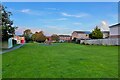


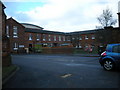
31 photos from this area
Area Information
Key information about the NN11 4DY including its size, population, and administrative classification.
- Area Type
- Postcode
- Area Size
- 9870 m²
- Population
- 1567
- Population Density
- 2417 people/km²
House Prices in NN11 4DY
21
Properties
-
Average Sold Price
-
Lowest Price
-
Highest Price
Showing 21 properties
| Address | Type | Beds | Baths | Last Sale Price | Last Sale Date | |
|---|---|---|---|---|---|---|
| Community Staff, Danetre Hospital, London Road, Daventry, NN11 4DY | commercial | - | - | - | - | |
| Outpatients, Danetre Hospital, London Road, Daventry, NN11 4DY | commercial | - | - | - | - | |
| Resturant, Danetre Hospital, London Road, Daventry, NN11 4DY | commercial | - | - | - | - | |
| Therapy Services, Danetre Hospital, London Road, Daventry, NN11 4DY | commercial | - | - | - | - | |
| Daventry Mental Health Resource Centre, Danetre Hospital, London Road, Daventry, NN11 4DY | hospital_care_home | - | - | - | - | |
| Northants Drugs & Alcohol Advisory Service, Danetre Hospital, London Road, Daventry, NN11 4DY | commercial | - | - | - | - | |
| X-ray Department, Danetre Hospital, London Road, Daventry, NN11 4DY | commercial | - | - | - | - | |
| Shop, Danetre Hospital, London Road, Daventry, NN11 4DY | shop | - | - | - | - | |
| Danetre Inpatients, Danetre Hospital, London Road, Daventry, NN11 4DY | commercial | - | - | - | - | |
| Main Reception, Danetre Hospital, London Road, Daventry, NN11 4DY | commercial | - | - | - | - |
Page 1 of 3
Energy Efficiency in NN11 4DY
Amenities
Schools
| Rank | School | Type | Entry gender | Ages |
|---|
Explore more schools in this area
Go to Schools tabDemographics
Household Size
Two person
most common
Accommodation Type
Houses
most common
Tenure
83
majority
Ethnic Group
White
most common
Religion
N/A
most common
Household Composition
N/A
most common
Age
47
median
Elderly (65+ years)
most common
Household Deprivation
N/A
with no deprivation
NS-SEC
28
in Lower managerial occupations
Explore more demographic insights in this area
Go to Demographics tabPlanning
Planning Constraints
- Flood RiskPremium
- Ramsar Wetland SitesPremium
- Area of Outstanding Natural BeautyPremium
- Protected Nature ReservePremium
- Protected WoodlandPremium