Area Overview for NN11 4DT
Photos of NN11 4DT
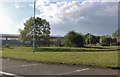


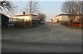
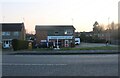
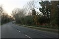
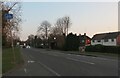
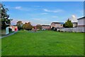


31 photos from this area
Area Information
Key information about the NN11 4DT including its size, population, and administrative classification.
- Area Type
- Postcode
- Area Size
- 3.1 hectares
- Population
- 1567
- Population Density
- 2417 people/km²
House Prices in NN11 4DT
22
Properties
£248,818
Average Sold Price
£70,000
Lowest Price
£415,000
Highest Price
Showing 22 properties
| Address | Type | Beds | Baths | Last Sale Price | Last Sale Date | |
|---|---|---|---|---|---|---|
| Sandling, 27 London Road, Daventry, NN11 4DT | Bungalow | - | - | £245,000 | Oct 2023 | |
| Belgrave House, 17 London Road, Daventry, NN11 4DT | house | - | - | £160,000 | Apr 2023 | |
| Woodley, 23 London Road, Daventry, NN11 4DT | Semi-detached | 3 | 1 | £282,000 | Mar 2023 | |
| Marholme Rise, 41 London Road, Daventry, NN11 4DT | Detached | 3 | 1 | £405,000 | Feb 2021 | |
| 21 London Road, Daventry, NN11 4DT | Semi-detached | 3 | 1 | £235,000 | Sep 2020 | |
| Autumn Fall, 49 London Road, Daventry, NN11 4DT | Detached | 3 | 2 | £415,000 | Jul 2019 | |
| Galloway, 29 London Road, Daventry, NN11 4DT | Detached | 4 | 2 | £355,000 | Apr 2017 | |
| Bramcote, 37 London Road, Daventry, NN11 4DT | Detached | 3 | - | £235,000 | Jan 2014 | |
| 25 London Road, Daventry, NN11 4DT | Detached | 5 | - | £220,000 | Nov 2003 | |
| Hillside, 33 London Road, Daventry, NN11 4DT | Semi-detached | - | - | £70,000 | Sep 1999 |
Page 1 of 3
Energy Efficiency in NN11 4DT
Amenities
Schools
| Rank | School | Type | Entry gender | Ages |
|---|
Explore more schools in this area
Go to Schools tabDemographics
Household Size
Two person
most common
Accommodation Type
Houses
most common
Tenure
83
majority
Ethnic Group
White
most common
Religion
N/A
most common
Household Composition
N/A
most common
Age
47
median
Elderly (65+ years)
most common
Household Deprivation
N/A
with no deprivation
NS-SEC
28
in Lower managerial occupations
Explore more demographic insights in this area
Go to Demographics tabPlanning
Planning Constraints
- Flood RiskPremium
- Ramsar Wetland SitesPremium
- Area of Outstanding Natural BeautyPremium
- Protected Nature ReservePremium
- Protected WoodlandPremium