Area Overview for NN11 4BP
Photos of NN11 4BP
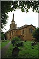
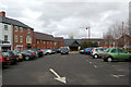
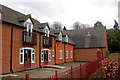
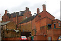
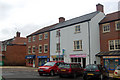
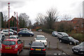
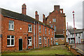
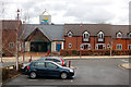
100 photos from this area
Area Information
Key information about the NN11 4BP including its size, population, and administrative classification.
- Area Type
- Postcode
- Area Size
- 1.3 hectares
- Population
- 1567
- Population Density
- 2417 people/km²
House Prices in NN11 4BP
17
Properties
£143,875
Average Sold Price
£124,995
Lowest Price
£175,000
Highest Price
Showing 17 properties
| Address | Type | Beds | Baths | Last Sale Price | Last Sale Date | |
|---|---|---|---|---|---|---|
| 5, Abbey Court, Thomas Webb Close, Daventry, NN11 4BP | Flat | - | - | £126,500 | Jan 2025 | |
| 7, Abbey Court, Thomas Webb Close, Daventry, NN11 4BP | Flat | 2 | 1 | £160,000 | Dec 2024 | |
| 12, Abbey Court, Thomas Webb Close, Daventry, NN11 4BP | Flat | - | - | £142,500 | Aug 2024 | |
| 8, Abbey Court, Thomas Webb Close, Daventry, NN11 4BP | Flat | - | - | £132,500 | Feb 2022 | |
| 3, Abbey Court, Thomas Webb Close, Daventry, NN11 4BP | Flat | - | - | £133,000 | Nov 2017 | |
| 16, Abbey Court, Thomas Webb Close, Daventry, NN11 4BP | house | 2 | 2 | £149,000 | Oct 2015 | |
| 10, Abbey Court, Thomas Webb Close, Daventry, NN11 4BP | Flat | - | - | £145,000 | Jun 2007 | |
| 14, Abbey Court, Thomas Webb Close, Daventry, NN11 4BP | Flat | 2 | 2 | £175,000 | May 2007 | |
| 6, Abbey Court, Thomas Webb Close, Daventry, NN11 4BP | Terraced | 3 | - | £124,995 | Mar 2007 | |
| 9, Abbey Court, Thomas Webb Close, Daventry, NN11 4BP | Flat | 2 | 1 | £157,500 | Dec 2006 |
Page 1 of 2
Energy Efficiency in NN11 4BP
Amenities
Schools
| Rank | School | Type | Entry gender | Ages |
|---|
Explore more schools in this area
Go to Schools tabDemographics
Household Size
Two person
most common
Accommodation Type
Houses
most common
Tenure
83
majority
Ethnic Group
White
most common
Religion
N/A
most common
Household Composition
N/A
most common
Age
47
median
Elderly (65+ years)
most common
Household Deprivation
N/A
with no deprivation
NS-SEC
28
in Lower managerial occupations
Explore more demographic insights in this area
Go to Demographics tabPlanning
Planning Constraints
- Flood RiskPremium
- Ramsar Wetland SitesPremium
- Area of Outstanding Natural BeautyPremium
- Protected Nature ReservePremium
- Protected WoodlandPremium