Area Overview for NN11 4AL
Photos of NN11 4AL
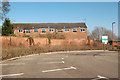
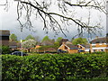
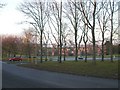
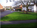
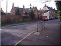
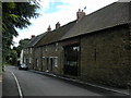
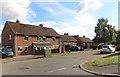
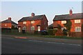
36 photos from this area
Area Information
Key information about the NN11 4AL including its size, population, and administrative classification.
- Area Type
- Postcode
- Area Size
- 6562 m²
- Population
- 2050
- Population Density
- 4053 people/km²
House Prices in NN11 4AL
19
Properties
£156,430
Average Sold Price
£40,000
Lowest Price
£253,000
Highest Price
Showing 19 properties
| Address | Type | Beds | Baths | Last Sale Price | Last Sale Date | |
|---|---|---|---|---|---|---|
| 96 Warwick Street, Daventry, NN11 4AL | Semi-detached | 3 | 1 | £253,000 | Nov 2024 | |
| 68 Warwick Street, Daventry, NN11 4AL | Terraced | 2 | 1 | £210,000 | Jan 2024 | |
| 66 Warwick Street, Daventry, NN11 4AL | Terraced | 3 | 2 | £157,000 | Feb 2022 | |
| 74 Warwick Street, Daventry, NN11 4AL | Terraced | 3 | 1 | £193,000 | Nov 2020 | |
| 86 Warwick Street, Daventry, NN11 4AL | Terraced | 3 | 1 | £163,500 | May 2019 | |
| 70 Warwick Street, Daventry, NN11 4AL | Terraced | 3 | 1 | £179,000 | Nov 2018 | |
| 90 Warwick Street, Daventry, NN11 4AL | Terraced | 3 | 1 | £186,500 | Jun 2018 | |
| 88 Warwick Street, Daventry, NN11 4AL | house | - | - | £116,000 | Oct 2013 | |
| 92 Warwick Street, Daventry, NN11 4AL | house | 3 | 2 | £82,500 | Sep 2013 | |
| 94 Warwick Street, Daventry, NN11 4AL | Terraced | 2 | 1 | £133,000 | Dec 2011 |
Page 1 of 2
Energy Efficiency in NN11 4AL
Amenities
Schools
| Rank | School | Type | Entry gender | Ages |
|---|
Explore more schools in this area
Go to Schools tabDemographics
Household Size
One person
most common
Accommodation Type
Houses
most common
Tenure
38
majority
Ethnic Group
White
most common
Religion
N/A
most common
Household Composition
N/A
most common
Age
47
median
Adults (30-64 years)
most common
Household Deprivation
N/A
with no deprivation
NS-SEC
22
in Lower managerial occupations
Explore more demographic insights in this area
Go to Demographics tabPlanning
Planning Constraints
- Flood RiskPremium
- Ramsar Wetland SitesPremium
- Area of Outstanding Natural BeautyPremium
- Protected Nature ReservePremium
- Protected WoodlandPremium