Area Overview for NN11 3SU
Photos of NN11 3SU
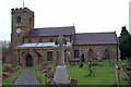
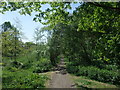
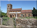
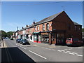


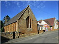
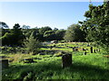
25 photos from this area
Area Information
Key information about the NN11 3SU including its size, population, and administrative classification.
- Area Type
- Postcode
- Area Size
- 1.2 hectares
- Population
- 2118
- Population Density
- 77 people/km²
House Prices in NN11 3SU
17
Properties
£276,462
Average Sold Price
£179,000
Lowest Price
£597,500
Highest Price
Showing 17 properties
| Address | Type | Beds | Baths | Last Sale Price | Last Sale Date | |
|---|---|---|---|---|---|---|
| The Cobbles, 28 Scrivens Hill, Woodford Halse, NN11 3SU | Semi-detached | 3 | 1 | £330,000 | Dec 2024 | |
| Meadow Bank, 27 Scrivens Hill, Woodford Halse, NN11 3SU | Detached | 3 | 1 | £295,000 | Dec 2024 | |
| 21 Scrivens Hill, Woodford Halse, NN11 3SU | house | - | - | £300,000 | Dec 2022 | |
| The Heathers, 26 Scrivens Hill, Woodford Halse, NN11 3SU | house | - | - | £270,000 | Feb 2022 | |
| Fresh Winds, 25 Scrivens Hill, Woodford Halse, NN11 3SU | Semi-detached | 3 | 1 | £223,000 | May 2021 | |
| 20 Scrivens Hill, Woodford Halse, NN11 3SU | Detached | 3 | 1 | £230,000 | Feb 2020 | |
| Torcrest, 17 Scrivens Hill, Woodford Halse, NN11 3SU | Semi-detached | 3 | 1 | £227,500 | Dec 2019 | |
| Silverdale, 28A Scrivens Hill, Woodford Halse, NN11 3SU | Detached | 4 | 2 | £597,500 | Jan 2019 | |
| Fairdene, 23 Scrivens Hill, Woodford Halse, NN11 3SU | Detached | 3 | 1 | £225,000 | Jun 2018 | |
| Woodlands, 33 Scrivens Hill, Woodford Halse, NN11 3SU | Detached | 4 | - | £288,000 | Oct 2015 |
Page 1 of 2
Energy Efficiency in NN11 3SU
Amenities
Schools
| Rank | School | Type | Entry gender | Ages |
|---|
Explore more schools in this area
Go to Schools tabDemographics
Household Size
Two person
most common
Accommodation Type
Houses
most common
Tenure
83
majority
Ethnic Group
White
most common
Religion
N/A
most common
Household Composition
N/A
most common
Age
47
median
Adults (30-64 years)
most common
Household Deprivation
N/A
with no deprivation
NS-SEC
37
in Lower managerial occupations
Explore more demographic insights in this area
Go to Demographics tabPlanning
Planning Constraints
- Flood RiskPremium
- Ramsar Wetland SitesPremium
- Area of Outstanding Natural BeautyPremium
- Protected Nature ReservePremium
- Protected WoodlandPremium