Area Overview for NN11 3RE
Photos of NN11 3RE
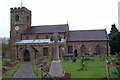
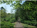
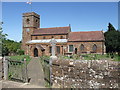
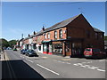
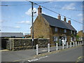

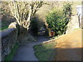

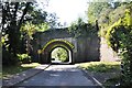
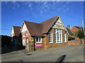
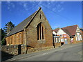
25 photos from this area
Area Information
Key information about the NN11 3RE including its size, population, and administrative classification.
- Area Type
- Postcode
- Area Size
- 1.3 hectares
- Population
- 2412
- Population Density
- 1015 people/km²
House Prices in NN11 3RE
18
Properties
£257,750
Average Sold Price
£65,000
Lowest Price
£815,000
Highest Price
Showing 18 properties
| Address | Type | Beds | Baths | Last Sale Price | Last Sale Date | |
|---|---|---|---|---|---|---|
| 8 Parsons Street, Woodford Halse, NN11 3RE | house | - | - | £376,000 | Feb 2022 | |
| 11 Parsons Street, Woodford Halse, NN11 3RE | Retail | 2 | 1 | £235,000 | Feb 2022 | |
| The Old Moravion Church, Parsons Street, Woodford Halse, NN11 3RE | Detached | - | - | £451,000 | Feb 2022 | |
| Divine Cottage, 9 Parsons Street, Woodford Halse, NN11 3RE | Terraced | 2 | 1 | £215,050 | Nov 2019 | |
| 6 Parsons Street, Woodford Halse, NN11 3RE | Bungalow | 1 | 1 | £145,000 | Jul 2018 | |
| 7 Parsons Street, Woodford Halse, NN11 3RE | house | 2 | - | £185,000 | Dec 2016 | |
| 3 Parsons Street, Woodford Halse, NN11 3RE | Terraced | 2 | 1 | £160,000 | Jan 2014 | |
| 4 Parsons Street, Woodford Halse, NN11 3RE | Bungalow | - | - | £141,950 | Oct 2013 | |
| The Old Vicarage, 1 Parsons Street, Woodford Halse, NN11 3RE | Detached | 5 | 3 | £815,000 | Jan 2008 | |
| 5 Parsons Street, Woodford Halse, NN11 3RE | Terraced | - | - | £164,500 | Jun 2004 |
Page 1 of 2
Energy Efficiency in NN11 3RE
Amenities
Schools
| Rank | School | Type | Entry gender | Ages |
|---|
Explore more schools in this area
Go to Schools tabDemographics
Household Size
Family (3-5 people)
most common
Accommodation Type
Houses
most common
Tenure
64
majority
Ethnic Group
White
most common
Religion
N/A
most common
Household Composition
N/A
most common
Age
47
median
Adults (30-64 years)
most common
Household Deprivation
N/A
with no deprivation
NS-SEC
30
in Lower managerial occupations
Explore more demographic insights in this area
Go to Demographics tabPlanning
Planning Constraints
- Flood RiskPremium
- Ramsar Wetland SitesPremium
- Area of Outstanding Natural BeautyPremium
- Protected Nature ReservePremium
- Protected WoodlandPremium