Area Overview for NN11 0RG
Photos of NN11 0RG
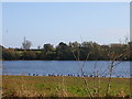
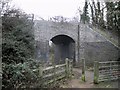
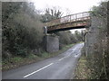
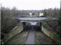
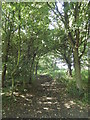
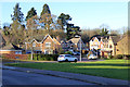
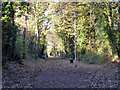
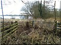
28 photos from this area
Area Information
Key information about the NN11 0RG including its size, population, and administrative classification.
- Area Type
- Postcode
- Area Size
- 1.6 hectares
- Population
- 1710
- Population Density
- 1235 people/km²
House Prices in NN11 0RG
33
Properties
£221,727
Average Sold Price
£53,000
Lowest Price
£455,000
Highest Price
Showing 33 properties
| Address | Type | Beds | Baths | Last Sale Price | Last Sale Date | |
|---|---|---|---|---|---|---|
| 20 Livingstone Road, Daventry, NN11 0RG | Detached | 4 | 3 | £330,000 | Aug 2025 | |
| 18 Livingstone Road, Daventry, NN11 0RG | Detached | 3 | 2 | £285,000 | Nov 2024 | |
| 24 Livingstone Road, Daventry, NN11 0RG | Detached | 4 | 2 | £455,000 | May 2024 | |
| 33 Livingstone Road, Daventry, NN11 0RG | Bungalow | 3 | 1 | £310,000 | Jul 2023 | |
| 23 Livingstone Road, Daventry, NN11 0RG | house | - | - | £226,000 | Feb 2022 | |
| 9 Livingstone Road, Daventry, NN11 0RG | house | - | - | £302,000 | Mar 2021 | |
| 12 Livingstone Road, Daventry, NN11 0RG | house | - | - | £320,000 | Dec 2020 | |
| 21 Livingstone Road, Daventry, NN11 0RG | Bungalow | 2 | - | £260,000 | Jul 2019 | |
| 1 Livingstone Road, Daventry, NN11 0RG | Detached | 4 | 2 | £331,000 | Mar 2019 | |
| 30 Livingstone Road, Daventry, NN11 0RG | Detached | 4 | 2 | £310,000 | Jul 2017 |
Page 1 of 4
Energy Efficiency in NN11 0RG
Amenities
Schools
| Rank | School | Type | Entry gender | Ages |
|---|
Explore more schools in this area
Go to Schools tabDemographics
Household Size
Two person
most common
Accommodation Type
Houses
most common
Tenure
73
majority
Ethnic Group
White
most common
Religion
N/A
most common
Household Composition
N/A
most common
Age
47
median
Adults (30-64 years)
most common
Household Deprivation
N/A
with no deprivation
NS-SEC
35
in Lower managerial occupations
Explore more demographic insights in this area
Go to Demographics tabPlanning
Planning Constraints
- Flood RiskPremium
- Ramsar Wetland SitesPremium
- Area of Outstanding Natural BeautyPremium
- Protected Nature ReservePremium
- Protected WoodlandPremium