Area Overview for NN10 9PE
Photos of NN10 9PE
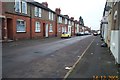
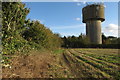
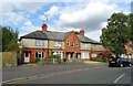
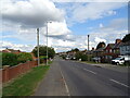
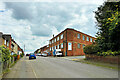
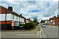
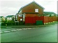
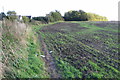
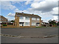
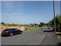
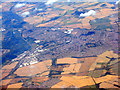
12 photos from this area
Area Information
Key information about the NN10 9PE including its size, population, and administrative classification.
- Area Type
- Postcode
- Area Size
- 11.2 hectares
- Population
- 1658
- Population Density
- 237 people/km²
House Prices in NN10 9PE
62
Properties
£207,698
Average Sold Price
£50,000
Lowest Price
£374,000
Highest Price
Showing 62 properties
| Address | Type | Beds | Baths | Last Sale Price | Last Sale Date | |
|---|---|---|---|---|---|---|
| 60 Whitefriars, Rushden, NN10 9PE | Bungalow | 3 | 1 | £335,000 | Oct 2024 | |
| 79 Whitefriars, Rushden, NN10 9PE | Detached | 3 | 2 | £374,000 | Jul 2024 | |
| 62 Whitefriars, Rushden, NN10 9PE | Bungalow | 3 | 1 | £262,000 | May 2024 | |
| 87 Whitefriars, Rushden, NN10 9PE | Bungalow | 3 | 2 | £285,000 | Oct 2023 | |
| 72 Whitefriars, Rushden, NN10 9PE | Bungalow | - | - | £310,000 | Sep 2023 | |
| 47 Whitefriars, Rushden, NN10 9PE | Retail | 3 | 1 | £292,500 | May 2022 | |
| 77 Whitefriars, Rushden, NN10 9PE | Bungalow | - | - | £300,000 | Feb 2022 | |
| 68 Whitefriars, Rushden, NN10 9PE | Bungalow | - | - | £320,000 | Sep 2021 | |
| 85 Whitefriars, Rushden, NN10 9PE | Bungalow | 3 | 1 | £240,000 | May 2019 | |
| 83 Whitefriars, Rushden, NN10 9PE | house | - | - | £310,000 | Feb 2019 |
Page 1 of 7
Energy Efficiency in NN10 9PE
Amenities
Schools
| Rank | School | Type | Entry gender | Ages |
|---|
Explore more schools in this area
Go to Schools tabDemographics
Household Size
One person
most common
Accommodation Type
Houses
most common
Tenure
60
majority
Ethnic Group
White
most common
Religion
N/A
most common
Household Composition
N/A
most common
Age
47
median
Adults (30-64 years)
most common
Household Deprivation
N/A
with no deprivation
NS-SEC
26
in Lower managerial occupations
Explore more demographic insights in this area
Go to Demographics tabPlanning
Planning Constraints
- Flood RiskPremium
- Ramsar Wetland SitesPremium
- Area of Outstanding Natural BeautyPremium
- Protected Nature ReservePremium
- Protected WoodlandPremium