Area Overview for NN10 9AD
Photos of NN10 9AD
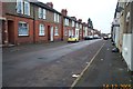
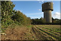
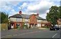
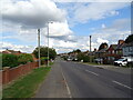
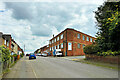
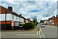
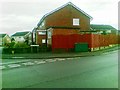
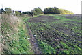
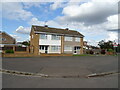
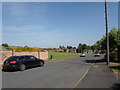
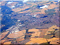
12 photos from this area
Area Information
Key information about the NN10 9AD including its size, population, and administrative classification.
- Area Type
- Postcode
- Area Size
- 1.0 hectares
- Population
- 1865
- Population Density
- 638 people/km²
House Prices in NN10 9AD
21
Properties
£188,920
Average Sold Price
£92,103
Lowest Price
£315,000
Highest Price
Showing 21 properties
| Address | Type | Beds | Baths | Last Sale Price | Last Sale Date | |
|---|---|---|---|---|---|---|
| 23 Farndish Close, Rushden, NN10 9AD | house | - | - | £315,000 | May 2021 | |
| 8 Farndish Close, Rushden, NN10 9AD | Detached | 4 | 2 | £297,500 | Nov 2017 | |
| 27 Farndish Close, Rushden, NN10 9AD | Detached | 4 | 3 | £305,000 | Aug 2017 | |
| 25 Farndish Close, Rushden, NN10 9AD | Detached | 4 | 3 | £230,000 | Mar 2016 | |
| 6 Farndish Close, Rushden, NN10 9AD | Detached | 4 | 2 | £253,000 | Dec 2015 | |
| 16 Farndish Close, Rushden, NN10 9AD | Detached | 3 | 2 | £227,000 | Jan 2015 | |
| 10 Farndish Close, Rushden, NN10 9AD | Detached | 3 | - | £166,000 | Nov 2013 | |
| 14 Farndish Close, Rushden, NN10 9AD | house | - | - | £173,000 | Sep 2012 | |
| 2 Farndish Close, Rushden, NN10 9AD | Detached | - | - | £190,000 | Dec 2009 | |
| 5 Farndish Close, Rushden, NN10 9AD | Detached | 4 | 2 | £220,000 | Jul 2007 |
Page 1 of 3
Energy Efficiency in NN10 9AD
Amenities
Schools
| Rank | School | Type | Entry gender | Ages |
|---|
Explore more schools in this area
Go to Schools tabDemographics
Household Size
Two person
most common
Accommodation Type
Houses
most common
Tenure
85
majority
Ethnic Group
White
most common
Religion
N/A
most common
Household Composition
N/A
most common
Age
47
median
Adults (30-64 years)
most common
Household Deprivation
N/A
with no deprivation
NS-SEC
35
in Lower managerial occupations
Explore more demographic insights in this area
Go to Demographics tabPlanning
Planning Constraints
- Flood RiskPremium
- Ramsar Wetland SitesPremium
- Area of Outstanding Natural BeautyPremium
- Protected Nature ReservePremium
- Protected WoodlandPremium