Area Overview for NN10 8JE
Photos of NN10 8JE

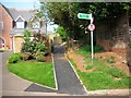
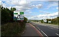
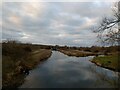
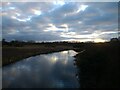
13 photos from this area
Area Information
Key information about the NN10 8JE including its size, population, and administrative classification.
- Area Type
- Postcode
- Area Size
- 1.3 hectares
- Population
- 2565
- Population Density
- 2309 people/km²
House Prices in NN10 8JE
19
Properties
£275,577
Average Sold Price
£137,000
Lowest Price
£472,000
Highest Price
Showing 19 properties
| Address | Type | Beds | Baths | Last Sale Price | Last Sale Date | |
|---|---|---|---|---|---|---|
| Elm Lodge, 20 Kings Meadow Lane, Higham Ferrers, NN10 8JE | Bungalow | 3 | - | £231,000 | Feb 2025 | |
| 7 Kings Meadow Lane, Higham Ferrers, NN10 8JE | Semi-detached | 3 | 3 | £472,000 | Apr 2021 | |
| 11 Kings Meadow Lane, Higham Ferrers, NN10 8JE | house | - | - | £228,000 | Dec 2019 | |
| 12 Kings Meadow Lane, Higham Ferrers, NN10 8JE | Terraced | 3 | 2 | £229,995 | Mar 2017 | |
| 17 Kings Meadow Lane, Higham Ferrers, NN10 8JE | Bungalow | - | - | £300,000 | Dec 2013 | |
| 14 Kings Meadow Lane, Higham Ferrers, NN10 8JE | Terraced | 3 | - | £137,000 | Oct 2013 | |
| 26 Kings Meadow Lane, Higham Ferrers, NN10 8JE | Detached | - | - | £336,000 | May 2007 | |
| 10 Kings Meadow Lane, Higham Ferrers, NN10 8JE | Flat | - | - | £172,500 | Jul 2005 | |
| 24 Kings Meadow Lane, Higham Ferrers, NN10 8JE | Detached | - | - | £250,000 | Mar 2003 | |
| 28 Kings Meadow Lane, Higham Ferrers, NN10 8JE | Detached | - | - | £328,500 | Mar 2003 |
Page 1 of 2
Energy Efficiency in NN10 8JE
Amenities
Schools
| Rank | School | Type | Entry gender | Ages |
|---|
Explore more schools in this area
Go to Schools tabDemographics
Household Size
Family (3-5 people)
most common
Accommodation Type
Houses
most common
Tenure
86
majority
Ethnic Group
White
most common
Religion
N/A
most common
Household Composition
N/A
most common
Age
47
median
Adults (30-64 years)
most common
Household Deprivation
N/A
with no deprivation
NS-SEC
42
in Lower managerial occupations
Explore more demographic insights in this area
Go to Demographics tabPlanning
Planning Constraints
- Flood RiskPremium
- Ramsar Wetland SitesPremium
- Area of Outstanding Natural BeautyPremium
- Protected Nature ReservePremium
- Protected WoodlandPremium