Area Overview for NN10 8DU
Photos of NN10 8DU
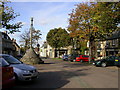
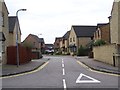


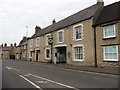
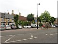

59 photos from this area
Area Information
Key information about the NN10 8DU including its size, population, and administrative classification.
- Area Type
- Postcode
- Area Size
- 9295 m²
- Population
- 2565
- Population Density
- 2309 people/km²
House Prices in NN10 8DU
30
Properties
£176,120
Average Sold Price
£55,000
Lowest Price
£345,000
Highest Price
Showing 30 properties
| Address | Type | Beds | Baths | Last Sale Price | Last Sale Date | |
|---|---|---|---|---|---|---|
| 11 Kimbolton Road, Higham Ferrers, NN10 8DU | Terraced | 3 | 1 | £325,000 | Aug 2025 | |
| 9 Kimbolton Road, Higham Ferrers, NN10 8DU | Bungalow | 2 | 1 | £345,000 | Nov 2024 | |
| 29 Kimbolton Road, Higham Ferrers, NN10 8DU | Terraced | 3 | 1 | £210,000 | May 2024 | |
| 43 Kimbolton Road, Higham Ferrers, NN10 8DU | Terraced | 2 | 1 | £236,000 | Sep 2022 | |
| 41 Kimbolton Road, Higham Ferrers, NN10 8DU | house | - | - | £150,000 | Mar 2022 | |
| 39 Kimbolton Road, Higham Ferrers, NN10 8DU | Terraced | 2 | 1 | £150,000 | Apr 2019 | |
| 1 Kimbolton Road, Higham Ferrers, NN10 8DU | Detached | 4 | 1 | £325,000 | Mar 2019 | |
| 17 Kimbolton Road, Higham Ferrers, NN10 8DU | Terraced | 2 | 2 | £155,000 | Jan 2015 | |
| 19 Kimbolton Road, Higham Ferrers, NN10 8DU | Terraced | 3 | 2 | £187,500 | Aug 2014 | |
| 21 Kimbolton Road, Higham Ferrers, NN10 8DU | Terraced | 3 | - | £120,000 | Dec 2013 |
Page 1 of 3
Energy Efficiency in NN10 8DU
Amenities
Schools
| Rank | School | Type | Entry gender | Ages |
|---|
Explore more schools in this area
Go to Schools tabDemographics
Household Size
Family (3-5 people)
most common
Accommodation Type
Houses
most common
Tenure
86
majority
Ethnic Group
White
most common
Religion
N/A
most common
Household Composition
N/A
most common
Age
47
median
Adults (30-64 years)
most common
Household Deprivation
N/A
with no deprivation
NS-SEC
42
in Lower managerial occupations
Explore more demographic insights in this area
Go to Demographics tabPlanning
Planning Constraints
- Flood RiskPremium
- Ramsar Wetland SitesPremium
- Area of Outstanding Natural BeautyPremium
- Protected Nature ReservePremium
- Protected WoodlandPremium