Area Overview for NN10 0NT
Photos of NN10 0NT
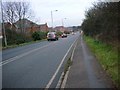
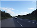
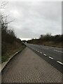


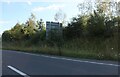

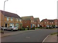
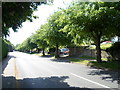
9 photos from this area
Area Information
Key information about the NN10 0NT including its size, population, and administrative classification.
- Area Type
- Postcode
- Area Size
- 8099 m²
- Population
- 1513
- Population Density
- 4545 people/km²
House Prices in NN10 0NT
16
Properties
£238,250
Average Sold Price
£83,000
Lowest Price
£355,000
Highest Price
Showing 16 properties
| Address | Type | Beds | Baths | Last Sale Price | Last Sale Date | |
|---|---|---|---|---|---|---|
| 3 Richmond Close, Rushden, NN10 0NT | Detached | 3 | 2 | £305,000 | Aug 2024 | |
| 6 Richmond Close, Rushden, NN10 0NT | Detached | 3 | 1 | £338,000 | Aug 2023 | |
| 14 Richmond Close, Rushden, NN10 0NT | Detached | 4 | 3 | £355,000 | Apr 2021 | |
| 12 Richmond Close, Rushden, NN10 0NT | house | - | - | £260,000 | Apr 2021 | |
| 5 Richmond Close, Rushden, NN10 0NT | Detached | 4 | 2 | £295,000 | Jun 2017 | |
| 4 Richmond Close, Rushden, NN10 0NT | Detached | 3 | - | £227,500 | Aug 2016 | |
| 8 Richmond Close, Rushden, NN10 0NT | Detached | 4 | 2 | £228,000 | Jul 2015 | |
| 17 Richmond Close, Rushden, NN10 0NT | Detached | 3 | - | £199,000 | Feb 2015 | |
| 1 Richmond Close, Rushden, NN10 0NT | Detached | 4 | 3 | £178,000 | May 2007 | |
| 10 Richmond Close, Rushden, NN10 0NT | Detached | - | - | £233,500 | May 2004 |
Page 1 of 2
Energy Efficiency in NN10 0NT
Amenities
Schools
| Rank | School | Type | Entry gender | Ages |
|---|
Explore more schools in this area
Go to Schools tabDemographics
Household Size
Family (3-5 people)
most common
Accommodation Type
Houses
most common
Tenure
82
majority
Ethnic Group
White
most common
Religion
N/A
most common
Household Composition
N/A
most common
Age
47
median
Adults (30-64 years)
most common
Household Deprivation
N/A
with no deprivation
NS-SEC
38
in Lower managerial occupations
Explore more demographic insights in this area
Go to Demographics tabPlanning
Planning Constraints
- Flood RiskPremium
- Ramsar Wetland SitesPremium
- Area of Outstanding Natural BeautyPremium
- Protected Nature ReservePremium
- Protected WoodlandPremium