Area Overview for NN1 4SP
Photos of NN1 4SP
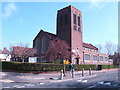
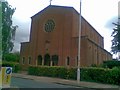
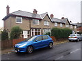
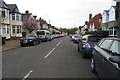
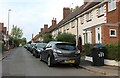
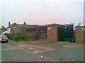
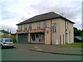
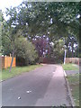
75 photos from this area
Area Information
Key information about the NN1 4SP including its size, population, and administrative classification.
- Area Type
- Postcode
- Area Size
- 1.1 hectares
- Population
- 1786
- Population Density
- 8257 people/km²
House Prices in NN1 4SP
29
Properties
£196,650
Average Sold Price
£52,500
Lowest Price
£410,000
Highest Price
Showing 29 properties
| Address | Type | Beds | Baths | Last Sale Price | Last Sale Date | |
|---|---|---|---|---|---|---|
| 122 The Drive, Northampton, NN1 4SP | house | 4 | 2 | £410,000 | Aug 2024 | |
| 116 The Drive, Northampton, NN1 4SP | Terraced | 3 | - | £260,000 | Feb 2024 | |
| 110 The Drive, Northampton, NN1 4SP | Terraced | 3 | 1 | £280,000 | Mar 2022 | |
| 72 The Drive, Northampton, NN1 4SP | Terraced | 3 | 2 | £288,495 | Sep 2021 | |
| 78 The Drive, Northampton, NN1 4SP | Terraced | 4 | 2 | £300,000 | Mar 2019 | |
| 104 The Drive, Northampton, NN1 4SP | house | - | - | £250,000 | Jun 2018 | |
| 86 The Drive, Northampton, NN1 4SP | Terraced | 3 | - | £184,995 | May 2014 | |
| 94 The Drive, Northampton, NN1 4SP | house | 4 | - | £182,500 | Jun 2013 | |
| 70 The Drive, Northampton, NN1 4SP | house | - | - | £143,000 | Jan 2011 | |
| 102 The Drive, Northampton, NN1 4SP | Terraced | - | - | £147,000 | Jun 2004 |
Page 1 of 3
Energy Efficiency in NN1 4SP
Amenities
Schools
| Rank | School | Type | Entry gender | Ages |
|---|
Explore more schools in this area
Go to Schools tabDemographics
Household Size
Family (3-5 people)
most common
Accommodation Type
Houses
most common
Tenure
78
majority
Ethnic Group
White
most common
Religion
N/A
most common
Household Composition
N/A
most common
Age
47
median
Adults (30-64 years)
most common
Household Deprivation
N/A
with no deprivation
NS-SEC
37
in Lower managerial occupations
Explore more demographic insights in this area
Go to Demographics tabPlanning
Planning Constraints
- Flood RiskPremium
- Ramsar Wetland SitesPremium
- Area of Outstanding Natural BeautyPremium
- Protected Nature ReservePremium
- Protected WoodlandPremium