Area Overview for NN1 4RW
Photos of NN1 4RW


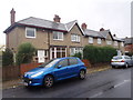
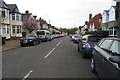
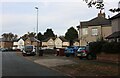
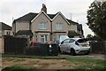
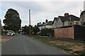
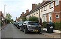
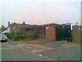
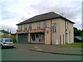
75 photos from this area
Area Information
Key information about the NN1 4RW including its size, population, and administrative classification.
- Area Type
- Postcode
- Area Size
- 1.3 hectares
- Population
- 1786
- Population Density
- 8257 people/km²
House Prices in NN1 4RW
60
Properties
£226,279
Average Sold Price
£47,000
Lowest Price
£337,500
Highest Price
Showing 60 properties
| Address | Type | Beds | Baths | Last Sale Price | Last Sale Date | |
|---|---|---|---|---|---|---|
| 55 Cedar Road, Northampton, NN1 4RW | Terraced | 5 | 2 | £250,000 | Oct 2025 | |
| 96 Cedar Road, Northampton, NN1 4RW | Terraced | 3 | 1 | £240,000 | Sep 2025 | |
| 75 Cedar Road, Northampton, NN1 4RW | Detached | 6 | 2 | £299,995 | Aug 2025 | |
| 74 Cedar Road, Northampton, NN1 4RW | Terraced | 3 | 1 | £282,000 | Apr 2025 | |
| 89 Cedar Road, Northampton, NN1 4RW | Terraced | 4 | 1 | £322,000 | Jul 2024 | |
| 101 Cedar Road, Northampton, NN1 4RW | Terraced | 3 | 1 | £310,000 | Dec 2023 | |
| 90 Cedar Road, Northampton, NN1 4RW | Terraced | 4 | 2 | £337,500 | Aug 2023 | |
| 98 Cedar Road, Northampton, NN1 4RW | Terraced | 3 | 1 | £275,000 | Jul 2023 | |
| 61 Cedar Road, Northampton, NN1 4RW | Terraced | 4 | 1 | £320,000 | Apr 2023 | |
| 97 Cedar Road, Northampton, NN1 4RW | house | - | - | £220,000 | Jul 2022 |
Page 1 of 6
Energy Efficiency in NN1 4RW
Amenities
Schools
| Rank | School | Type | Entry gender | Ages |
|---|
Explore more schools in this area
Go to Schools tabDemographics
Household Size
Family (3-5 people)
most common
Accommodation Type
Houses
most common
Tenure
78
majority
Ethnic Group
White
most common
Religion
N/A
most common
Household Composition
N/A
most common
Age
47
median
Adults (30-64 years)
most common
Household Deprivation
N/A
with no deprivation
NS-SEC
37
in Lower managerial occupations
Explore more demographic insights in this area
Go to Demographics tabPlanning
Planning Constraints
- Flood RiskPremium
- Ramsar Wetland SitesPremium
- Area of Outstanding Natural BeautyPremium
- Protected Nature ReservePremium
- Protected WoodlandPremium