Area Overview for NN1 4RL
Photos of NN1 4RL
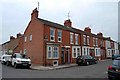
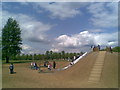
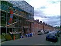
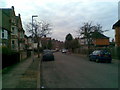
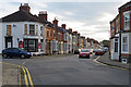
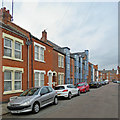
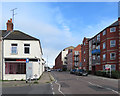
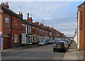

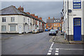
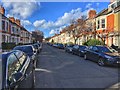
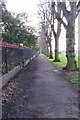
98 photos from this area
Area Information
Key information about the NN1 4RL including its size, population, and administrative classification.
- Area Type
- Postcode
- Area Size
- 7240 m²
- Population
- 1786
- Population Density
- 8257 people/km²
House Prices in NN1 4RL
48
Properties
£222,081
Average Sold Price
£61,500
Lowest Price
£365,000
Highest Price
Showing 48 properties
| Address | Type | Beds | Baths | Last Sale Price | Last Sale Date | |
|---|---|---|---|---|---|---|
| 35 Collingwood Road, Northampton, NN1 4RL | Terraced | 3 | 1 | £289,625 | Feb 2025 | |
| 24 Collingwood Road, Northampton, NN1 4RL | Terraced | 3 | 1 | £365,000 | Dec 2022 | |
| 27 Collingwood Road, Northampton, NN1 4RL | Terraced | 3 | 1 | £295,000 | Nov 2022 | |
| 51 Collingwood Road, Northampton, NN1 4RL | Terraced | 3 | 1 | £325,000 | Jun 2022 | |
| 61 Collingwood Road, Northampton, NN1 4RL | house | - | - | £257,500 | Jan 2022 | |
| 53 Collingwood Road, Northampton, NN1 4RL | house | 3 | 1 | £325,000 | Jan 2021 | |
| 41 Collingwood Road, Northampton, NN1 4RL | house | - | - | £245,000 | Aug 2019 | |
| 47 Collingwood Road, Northampton, NN1 4RL | Terraced | 3 | - | £285,000 | Feb 2019 | |
| 45 Collingwood Road, Northampton, NN1 4RL | Terraced | 3 | - | £273,000 | Dec 2017 | |
| 30 Collingwood Road, Northampton, NN1 4RL | Terraced | 3 | - | £250,000 | Sep 2017 |
Page 1 of 5
Energy Efficiency in NN1 4RL
Amenities
Schools
| Rank | School | Type | Entry gender | Ages |
|---|
Explore more schools in this area
Go to Schools tabDemographics
Household Size
Family (3-5 people)
most common
Accommodation Type
Houses
most common
Tenure
78
majority
Ethnic Group
White
most common
Religion
N/A
most common
Household Composition
N/A
most common
Age
47
median
Adults (30-64 years)
most common
Household Deprivation
N/A
with no deprivation
NS-SEC
37
in Lower managerial occupations
Explore more demographic insights in this area
Go to Demographics tabPlanning
Planning Constraints
- Flood RiskPremium
- Ramsar Wetland SitesPremium
- Area of Outstanding Natural BeautyPremium
- Protected Nature ReservePremium
- Protected WoodlandPremium