Area Overview for NN1 4BG
Photos of NN1 4BG
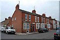
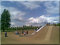
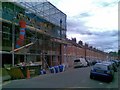
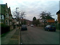
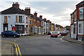
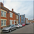
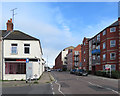
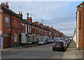

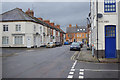
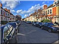
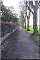
98 photos from this area
Area Information
Key information about the NN1 4BG including its size, population, and administrative classification.
- Area Type
- Postcode
- Area Size
- 5169 m²
- Population
- 2177
- Population Density
- 12598 people/km²
House Prices in NN1 4BG
39
Properties
£63,549
Average Sold Price
£13,000
Lowest Price
£104,000
Highest Price
Showing 39 properties
| Address | Type | Beds | Baths | Last Sale Price | Last Sale Date | |
|---|---|---|---|---|---|---|
| 36 Brunswick Place, Northampton, NN1 4BG | Flat | 1 | 1 | £87,500 | Mar 2016 | |
| 3 Brunswick Place, Northampton, NN1 4BG | Flat | - | - | £62,000 | May 2010 | |
| 33 Brunswick Place, Northampton, NN1 4BG | Flat | 1 | 1 | £67,500 | Mar 2010 | |
| 17 Brunswick Place, Northampton, NN1 4BG | Flat | 3 | 1 | £104,000 | Nov 2006 | |
| 16 Brunswick Place, Northampton, NN1 4BG | Flat | - | - | £86,950 | Sep 2005 | |
| 9 Brunswick Place, Northampton, NN1 4BG | Terraced | - | - | £77,000 | Jan 2003 | |
| 35 Brunswick Place, Northampton, NN1 4BG | Flat | 1 | 1 | £49,995 | Sep 2002 | |
| 22 Brunswick Place, Northampton, NN1 4BG | Terraced | - | - | £13,000 | Mar 2001 | |
| 27 Brunswick Place, Northampton, NN1 4BG | Flat | - | - | £24,000 | Dec 1995 | |
| 12B Brunswick Place, Northampton, NN1 4BG | house | - | - | - | - |
Page 1 of 4
Energy Efficiency in NN1 4BG
Amenities
Schools
| Rank | School | Type | Entry gender | Ages |
|---|
Explore more schools in this area
Go to Schools tabDemographics
Household Size
One person
most common
Accommodation Type
Flats
most common
Tenure
28
majority
Ethnic Group
White
most common
Religion
N/A
most common
Household Composition
N/A
most common
Age
47
median
Adults (30-64 years)
most common
Household Deprivation
N/A
with no deprivation
NS-SEC
20
in Lower managerial occupations
Explore more demographic insights in this area
Go to Demographics tabPlanning
Planning Constraints
- Flood RiskPremium
- Ramsar Wetland SitesPremium
- Area of Outstanding Natural BeautyPremium
- Protected Nature ReservePremium
- Protected WoodlandPremium