Area Overview for NG9 6RS
Photos of NG9 6RS
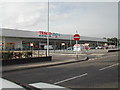
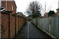
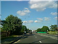
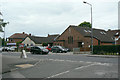
100 photos from this area
Area Information
Key information about the NG9 6RS including its size, population, and administrative classification.
- Area Type
- Postcode
- Area Size
- 3914 m²
- Population
- 2436
- Population Density
- 3640 people/km²
House Prices in NG9 6RS
33
Properties
£136,883
Average Sold Price
£75,000
Lowest Price
£260,000
Highest Price
Showing 33 properties
| Address | Type | Beds | Baths | Last Sale Price | Last Sale Date | |
|---|---|---|---|---|---|---|
| 24 Shaw Road, Chilwell, NG9 6RS | Flat | 1 | 1 | £117,500 | Nov 2024 | |
| 4 Shaw Road, Chilwell, NG9 6RS | Flat | 2 | - | £132,000 | Apr 2024 | |
| 6 Shaw Road, Chilwell, NG9 6RS | Flat | - | - | £145,000 | Jan 2024 | |
| 46 Shaw Road, Chilwell, NG9 6RS | Flat | 2 | 2 | £145,000 | Feb 2023 | |
| 64 Shaw Road, Chilwell, NG9 6RS | house | - | - | £260,000 | Jan 2022 | |
| 28 Shaw Road, Chilwell, NG9 6RS | Flat | - | - | £123,000 | Nov 2020 | |
| 42 Shaw Road, Chilwell, NG9 6RS | Flat | - | - | £105,500 | Nov 2020 | |
| 60 Shaw Road, Chilwell, NG9 6RS | Semi-detached | 4 | 2 | £212,500 | Oct 2020 | |
| 56 Shaw Road, Chilwell, NG9 6RS | house | 4 | 2 | £210,000 | Jan 2020 | |
| 14 Shaw Road, Chilwell, NG9 6RS | Flat | - | - | £120,000 | Oct 2019 |
Page 1 of 4
Energy Efficiency in NG9 6RS
Amenities
Schools
| Rank | School | Type | Entry gender | Ages |
|---|
Explore more schools in this area
Go to Schools tabDemographics
Household Size
Two person
most common
Accommodation Type
Houses
most common
Tenure
76
majority
Ethnic Group
White
most common
Religion
N/A
most common
Household Composition
N/A
most common
Age
47
median
Adults (30-64 years)
most common
Household Deprivation
N/A
with no deprivation
NS-SEC
52
in Lower managerial occupations
Explore more demographic insights in this area
Go to Demographics tabPlanning
Planning Constraints
- Flood RiskPremium
- Ramsar Wetland SitesPremium
- Area of Outstanding Natural BeautyPremium
- Protected Nature ReservePremium
- Protected WoodlandPremium