Area Overview for NG9 5HN
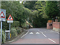
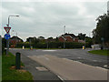
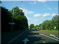
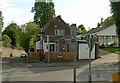
Photos of NG9 5HN


Area Information
The postcode NG9 5HN designates a specific residential cluster covering 2,079 square metres. With a population of 2,034 people, this area represents a compact community where residents live in close proximity. You are entering an established locale where daily life revolves around a high density of neighbours within a relatively small footprint. The location benefits from extensive digital infrastructure, which supports modern remote working and entertainment needs. A safety score of 80 out of 100 indicates that crime rates here fall below the national average, providing a secure environment for families and individuals alike. There are no planning constraints such as Ramsar wetland sites, Areas of Outstanding Natural Beauty, or protected woodlands that might complicate future property developments or modifications. This freedom offers certainty for homeowners considering extensions or other improvements. The area is characterised by a settled atmosphere rather than rapid change. Every aspect of your life here, from walking to the shops to sitting in your garden, happens within a manageable and well-defined space. Living in NG9 5HN means you have a clear picture of your immediate surroundings and the routine you will maintain. The combination of low flood risk and a robust crime safety score creates a stable backdrop for your daily activities.
- Area Type
- Postcode
- Area Size
- 2079 m²
- Population
- 2034
- Population Density
- 3997 people/km²
The property market in NG9 5HN is overwhelmingly characterised by owner-occupied homes. With 80 percent of the population owning their residences, you are looking at an area where people stay for the long term rather than renting short-term periods. The primary accommodation type in this postcode is houses, which aligns perfectly with the demographic data showing a median age of 47. This means you can expect a stock of family-sized properties that have likely been adapted over decades by their various owners. There are no significant pockets of flat living or student housing to disrupt the market character. For buyers entering this small but defined area, the message is clear: this is a traditional family enclave. The presence of 2,034 residents within 2,079 square metres creates a high density of housing, meaning properties are in regular demand from local families looking to move nearby. You will not find a volatile rental market here; instead, the demand comes from people seeking to join an established community of homeowners who value space and stability. The consistency of the home ownership rate provides a reliable indicator of market health and resident satisfaction.
House Prices in NG9 5HN
No properties found in this postcode.
Energy Efficiency in NG9 5HN
Your daily lifestyle in NG9 5HN benefits from immediate access to essential retail and transport hubs. You will find five retail locations nearby, including Co-op Bramcote, Heron Chilwell, and Tesco Chilwell. These venues provide everything from groceries to convenience shopping without the need for long drives. Your transport life is flexible, with five rail stations and five metro stops located within reach. You can utilise Bramcote Lane Tram Stop, Sandby Court, and Eskdale Drive for regular commutes. The convenience of these amenities means you can run errands quickly or enjoy a local coffee without leaving the neighbourhood. The area supports a straightforward, functional routine where basic needs are met locally. Living in NG9 5HN offers a lifestyle where practicality meets comfort, allowing you to focus on your home and community.
Amenities
Schools
Families living in NG9 5HN have direct access to quality local education. The closest primary school is Meadow Lane Infant School, which serves the youngest members of the community. This institution is part of the network of schools near NG9 5HN that cater to the needs of local children. While the data confirms the presence of these educational facilities, it does not provide Ofsted ratings for the specific establishments listed. Consequently, you will need to consult the official Department for Education website to review the current performance grades for Meadow Lane Infant School. The existence of dedicated infant schooling within practical reach means parents can manage school runs without travelling across town. The focus on infant education suggests that this is a family-friendly zone where early childhood development is supported by local infrastructure.
| Rank | School | Type | Entry gender | Ages |
|---|
Explore more schools in this area
Go to Schools tabDemographics
The community in NG9 5HN is defined by a mature and settled population. The median age stands at 47 years, reflecting a household structure dominated by adults between 30 and 64 years old. This age profile suggests a neighbourhood where stability is a priority and parents with grown children often reside alongside professionals later in their careers. Home ownership is the dominant housing tenure, with 80 percent of residents owning their accommodation. This high level of ownership typically correlates with long-term settlement and investment in local improvements. The predominant ethnic group is White, which aligns with the area's established demographic character. The vast majority of dwellings are houses, underscoring a preference for traditional living spaces over flats or shared houses. You will find a community where people have put down roots. The low crime risk score of 80 supports an environment where families feel comfortable allowing children to play and neighbours to gather outside. This demographic mix creates a quiet, suburban rhythm that prioritises family time and domestic comfort over transient urban activity.
Household Size
Accommodation Type
Tenure
Ethnic Group
Religion
Household Composition
Age
Household Deprivation
NS-SEC
Explore more demographic insights in this area
Go to Demographics tabPlanning
Planning Constraints
- Flood RiskPremium
- Ramsar Wetland SitesPremium
- Area of Outstanding Natural BeautyPremium
- Protected Nature ReservePremium
- Protected WoodlandPremium