Area Overview for NG9 5HH
Photos of NG9 5HH
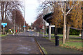
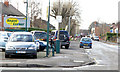
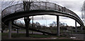
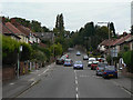
90 photos from this area
Area Information
Key information about the NG9 5HH including its size, population, and administrative classification.
- Area Type
- Postcode
- Area Size
- 4751 m²
- Population
- 2034
- Population Density
- 3997 people/km²
House Prices in NG9 5HH
9
Properties
£164,000
Average Sold Price
£73,000
Lowest Price
£260,000
Highest Price
Showing 9 properties
| Address | Type | Beds | Baths | Last Sale Price | Last Sale Date | |
|---|---|---|---|---|---|---|
| 146 Bye Pass Road, Chilwell, NG9 5HH | house | - | - | £260,000 | Jan 2022 | |
| 134 Bye Pass Road, Chilwell, NG9 5HH | Bungalow | 2 | 1 | £216,000 | May 2020 | |
| 144 Bye Pass Road, Chilwell, NG9 5HH | Semi-detached | 3 | 1 | £178,000 | Dec 2016 | |
| 142 Bye Pass Road, Chilwell, NG9 5HH | Semi-detached | 3 | - | £115,000 | Nov 2014 | |
| 138 Bye Pass Road, Chilwell, NG9 5HH | house | 3 | - | £147,500 | Aug 2012 | |
| 136 Bye Pass Road, Chilwell, NG9 5HH | Semi-detached | - | - | £158,500 | Jan 2008 | |
| 130 Bye Pass Road, Chilwell, NG9 5HH | Bungalow | 3 | 1 | £73,000 | Apr 2000 | |
| 132 Bye Pass Road, Chilwell, NG9 5HH | Bungalow | 2 | 1 | - | - | |
| 140 Bye Pass Road, Chilwell, NG9 5HH | Semi-detached | - | - | - | - |
Energy Efficiency in NG9 5HH
Amenities
Schools
| Rank | School | Type | Entry gender | Ages |
|---|
Explore more schools in this area
Go to Schools tabDemographics
Household Size
Two person
most common
Accommodation Type
Houses
most common
Tenure
80
majority
Ethnic Group
White
most common
Religion
N/A
most common
Household Composition
N/A
most common
Age
47
median
Adults (30-64 years)
most common
Household Deprivation
N/A
with no deprivation
NS-SEC
42
in Lower managerial occupations
Explore more demographic insights in this area
Go to Demographics tabPlanning
Planning Constraints
- Flood RiskPremium
- Ramsar Wetland SitesPremium
- Area of Outstanding Natural BeautyPremium
- Protected Nature ReservePremium
- Protected WoodlandPremium