Area Overview for NG9 4DP
Photos of NG9 4DP
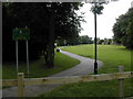
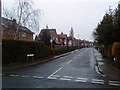
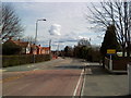
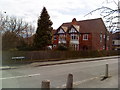
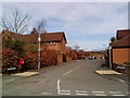
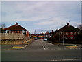
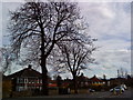
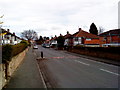
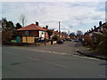
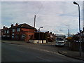
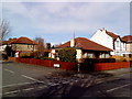
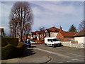
100 photos from this area
Area Information
Key information about the NG9 4DP including its size, population, and administrative classification.
- Area Type
- Postcode
- Area Size
- 2.4 hectares
- Population
- 1590
- Population Density
- 774 people/km²
House Prices in NG9 4DP
18
Properties
£333,764
Average Sold Price
£78,000
Lowest Price
£1,825,000
Highest Price
Showing 18 properties
| Address | Type | Beds | Baths | Last Sale Price | Last Sale Date | |
|---|---|---|---|---|---|---|
| Queenswood, 2 Cliffgrove Avenue, Chilwell, NG9 4DP | hospital_care_home | - | - | £1,825,000 | Mar 2024 | |
| 17 Cliffgrove Avenue, Chilwell, NG9 4DP | Semi-detached | 3 | - | £315,000 | Feb 2022 | |
| 23 Cliffgrove Avenue, Chilwell, NG9 4DP | house | - | - | £245,000 | Sep 2021 | |
| 29 Cliffgrove Avenue, Chilwell, NG9 4DP | Detached | 3 | 2 | £245,000 | Jun 2016 | |
| 7 Cliffgrove Avenue, Chilwell, NG9 4DP | Detached | 3 | - | £249,950 | Aug 2014 | |
| 25 Cliffgrove Avenue, Chilwell, NG9 4DP | Detached | 3 | 1 | £165,000 | Jan 2011 | |
| 9 Cliffgrove Avenue, Chilwell, NG9 4DP | Detached | - | - | £250,000 | Apr 2009 | |
| 19 Cliffgrove Avenue, Chilwell, NG9 4DP | Semi-detached | - | - | £125,000 | Mar 2009 | |
| 3 Cliffgrove Avenue, Chilwell, NG9 4DP | Detached | - | - | £88,950 | Jul 1999 | |
| 31 Cliffgrove Avenue, Chilwell, NG9 4DP | Detached | - | - | £84,500 | Jun 1998 |
Page 1 of 2
Energy Efficiency in NG9 4DP
Amenities
Schools
| Rank | School | Type | Entry gender | Ages |
|---|
Explore more schools in this area
Go to Schools tabDemographics
Household Size
Two person
most common
Accommodation Type
Houses
most common
Tenure
85
majority
Ethnic Group
White
most common
Religion
N/A
most common
Household Composition
N/A
most common
Age
47
median
Adults (30-64 years)
most common
Household Deprivation
N/A
with no deprivation
NS-SEC
50
in Lower managerial occupations
Explore more demographic insights in this area
Go to Demographics tabPlanning
Planning Constraints
- Flood RiskPremium
- Ramsar Wetland SitesPremium
- Area of Outstanding Natural BeautyPremium
- Protected Nature ReservePremium
- Protected WoodlandPremium