Area Overview for NG9 3ST
Photos of NG9 3ST
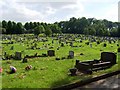
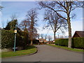
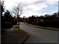
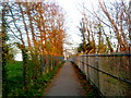
57 photos from this area
Area Information
Key information about the NG9 3ST including its size, population, and administrative classification.
- Area Type
- Postcode
- Area Size
- 4.8 hectares
- Population
- 1769
- Population Density
- 5214 people/km²
House Prices in NG9 3ST
27
Properties
£273,668
Average Sold Price
£160,000
Lowest Price
£480,000
Highest Price
Showing 27 properties
| Address | Type | Beds | Baths | Last Sale Price | Last Sale Date | |
|---|---|---|---|---|---|---|
| 1 Bramwell Drive, Bramcote, NG9 3ST | Detached | 4 | 2 | £480,000 | Mar 2025 | |
| 4 Bramwell Drive, Bramcote, NG9 3ST | Detached | 3 | 2 | £310,000 | Jan 2024 | |
| 34 Bramwell Drive, Bramcote, NG9 3ST | Semi-detached | 3 | 2 | £216,000 | Apr 2019 | |
| 16 Bramwell Drive, Bramcote, NG9 3ST | Detached | 4 | 1 | £345,000 | Oct 2017 | |
| 3 Bramwell Drive, Bramcote, NG9 3ST | Detached | 4 | - | £360,000 | Feb 2017 | |
| 5 Bramwell Drive, Bramcote, NG9 3ST | Detached | 4 | 2 | £315,000 | Dec 2015 | |
| 9 Bramwell Drive, Bramcote, NG9 3ST | Semi-detached | 3 | - | £200,000 | Oct 2014 | |
| 2 Bramwell Drive, Bramcote, NG9 3ST | Detached | 4 | - | £314,950 | Jul 2014 | |
| 19 Bramwell Drive, Bramcote, NG9 3ST | Detached | 5 | 2 | £285,000 | Jul 2011 | |
| 12 Bramwell Drive, Bramcote, NG9 3ST | Detached | - | - | £243,000 | Oct 2009 |
Page 1 of 3
Energy Efficiency in NG9 3ST
Amenities
Schools
| Rank | School | Type | Entry gender | Ages |
|---|
Explore more schools in this area
Go to Schools tabDemographics
Household Size
Two person
most common
Accommodation Type
Houses
most common
Tenure
74
majority
Ethnic Group
White
most common
Religion
N/A
most common
Household Composition
N/A
most common
Age
47
median
Adults (30-64 years)
most common
Household Deprivation
N/A
with no deprivation
NS-SEC
44
in Lower managerial occupations
Explore more demographic insights in this area
Go to Demographics tabPlanning
Planning Constraints
- Flood RiskPremium
- Ramsar Wetland SitesPremium
- Area of Outstanding Natural BeautyPremium
- Protected Nature ReservePremium
- Protected WoodlandPremium