Area Overview for NG9 3RT
Photos of NG9 3RT


Area Information
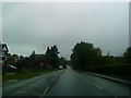
Living in NG9 3RT offers a settled residential experience within a specific cluster that supports approximately 1,300 people. This postcode covers a small, focused area where daily life centres on established neighbourhood patterns rather than rapid development. The location is defined by its concentration of households and proximity to key local infrastructure. Residents here experience a community built around stability, with limited population pressure compared to larger urban centres nearby. You will find a residence pattern that prioritises established homes over transient accommodation. The area sits within Nottinghamshire, providing access to wider regional routes while maintaining a local character. Daily routines involve short commutes to surrounding employment hubs and direct access to necessary services. The layout of NG9 3RT supports a quiet lifestyle, avoiding the congestion found in more densely populated zones. You move through an environment where neighbours know one another, fostering a sense of local ownership without the intensity of high-rise blocks. The physical space allows for breathing room, making it suitable for families and older residents alike. While the area is not vast, its efficiency in service delivery and connectivity ensures that practical daily needs are met without excessive travel time. This postcode represents a choice for those seeking a defined address with clear boundaries and a manageable community size.
- Area Type
- Postcode
- Area Size
- Not available
- Population
- 1300
- Population Density
- 2339 people/km²
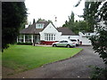
Homes in NG9 3RT are overwhelmingly owned by those who live there. With a 92 percent homeownership rate, the market functions as a long-term residential zone rather than a hub for short-term rentals. This statistic aligns with the accommodation type, which consists solely of houses. You will not see purpose-built blocks of flats or shared housing schemes typical of higher-density urban districts. Instead, the plot reflects a traditional suburban or semi-rural development pattern where individuals purchase and maintain single-family units. The high ownership percentage means sellers often have significant equity and may be reluctant to move quickly without strong offers. Prospective buyers should prepare for a market driven by owner financing and equity release rather than tenant demand. This dynamic stabilises property values but can lengthen transaction times. The absence of rental properties simplifies the investment picture; you are buying a home to live in, not a unit for a portfolio. The specific postcode cluster suggests a tight-knit real estate group where local knowledge outweighs broad market analysis. Investors looking for cash-flow properties from rentals will find limited opportunity here. Instead, the focus remains on capital growth and household stability within this rarefied group of houses.
House Prices in NG9 3RT
No properties found in this postcode.
Energy Efficiency in NG9 3RT
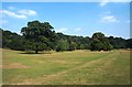
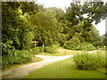
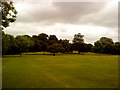
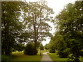
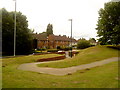
Your lifestyle in NG9 3RT revolves around convenient access to a range of amenities within practical reach. Retail options are solid, with five significant locations close by. Notable venues include Co-op Hicklings, Tesco Wollaton, and Sainsburys Wollaton. These supermarkets cover your daily grocery and household needs without requiring a long journey into a city centre. For public transport, you have five metro stops nearby, including Sandby Court, Bramcote Lane Tram Stop, and Eskdale Drive. This network complements nearby rail services at Beeston Railway Station, Attenborough Railway Station, and Ilkeston Railway Station. The mix of shops and transport hubs supports a self-sufficient daily routine. You can manage errands, routine shopping, and commuting without relying heavily on a car. The area feels functional rather than purely recreational, focusing on utility and efficiency. While parks or large leisure centres are not explicitly detailed in the immediate amenity data, the presence of community colleges and schools implies local green spaces or community grounds that serve the neighbourhood. Living here means your routine is planned around accessible, named venues like the supermarkets and tram stops. The character is one of reliable convenience, where the essentials are close by.
Amenities
Schools
Families living in NG9 3RT have access to two specific educational institutions nearby. Bramcote Hills Primary School operates as a primary school and holds a 'good' Ofsted rating. This recognition indicates consistent educational standards and effective teaching practices. It is a central option for younger children within reach of the postcode. A second facility, Bramcote Hills Sport and Community College, also lists as a primary school in records. The presence of two institutions supports local families without forcing them into long commutes for primary education. While secondary options are not listed in the immediate data, the proximity of these primary schools suggests a neighbourhood designed for young children. The 'good' rating of Bramcote Hills Primary is a key advantage for parents prioritising academic performance and Ofsted recognition. You do not need to travel far for a recognised primary education. The mix of schools nearby ensures that children growing up in NG9 3RT have local educational options without relying entirely on distant hubs. This setup works well for families who wish to keep children close to home for their developmental years.
| Rank | School | Type | Entry gender | Ages |
|---|
Explore more schools in this area
Go to Schools tabDemographics
The community in NG9 3RT reflects a mature population, with a median age of 47 years. Most residents fall into the adult category, spanning ages 30 to 64, which indicates a demographic focused on family life and mid-career stability. Homeownership is extremely common, standing at 92 percent. This high rate suggests that the majority of households have established roots in the neighbourhood and are unlikely to move frequently. The accommodation type is exclusively houses, meaning you will not find apartments or flats within this specific cluster. This housing stock typically suits larger families or couples who require space rather than high-density living. The predominant ethnic group is White, which aligns with the broader demographic profile of many established residential areas in the region. The age distribution means that families with school-age children are a significant part of the local scene, and there are fewer young singles or retirees living alone compared to other age-heavy zones. Economic hardship indicators are not highlighted in the provided data, but the high ownership rate implies long-term financial commitment to property. You are entering an area where residents value stability and have secured their housing status. The lack of renting activity further distinguishes this from cities with large student populations or transient workers. It is a neighbourhood where people stay.
Household Size
Accommodation Type
Tenure
Ethnic Group
Religion
Household Composition
Age
Household Deprivation
NS-SEC
Explore more demographic insights in this area
Go to Demographics tabPlanning
Planning Constraints
- Flood RiskPremium
- Ramsar Wetland SitesPremium
- Area of Outstanding Natural BeautyPremium
- Protected Nature ReservePremium
- Protected WoodlandPremium