Area Overview for NG9 3FW
Photos of NG9 3FW
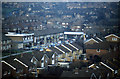
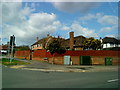
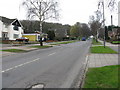
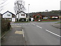
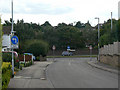
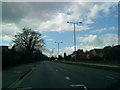
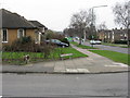
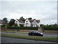
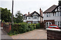
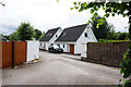
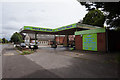
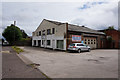
62 photos from this area
Area Information
Key information about the NG9 3FW including its size, population, and administrative classification.
- Area Type
- Postcode
- Area Size
- 2.4 hectares
- Population
- 1300
- Population Density
- 2339 people/km²
House Prices in NG9 3FW
47
Properties
£265,134
Average Sold Price
£74,000
Lowest Price
£485,000
Highest Price
Showing 47 properties
| Address | Type | Beds | Baths | Last Sale Price | Last Sale Date | |
|---|---|---|---|---|---|---|
| 40 Seven Oaks Crescent, Bramcote, NG9 3FW | Detached | 3 | 1 | £480,000 | Sep 2025 | |
| 2A Seven Oaks Crescent, Bramcote, NG9 3FW | Detached | 1 | 3 | £401,175 | Jan 2025 | |
| 24 Seven Oaks Crescent, Bramcote, NG9 3FW | Detached | 4 | 2 | £485,000 | Sep 2023 | |
| 38 Seven Oaks Crescent, Bramcote, NG9 3FW | Retail | 3 | 1 | £387,000 | May 2022 | |
| 31A Seven Oaks Crescent, Bramcote, NG9 3FW | Bungalow | 2 | 1 | £265,000 | Mar 2022 | |
| 27 Seven Oaks Crescent, Bramcote, NG9 3FW | house | 3 | - | £315,000 | Jan 2022 | |
| 28 Seven Oaks Crescent, Bramcote, NG9 3FW | house | - | - | £375,000 | Sep 2021 | |
| 36 Seven Oaks Crescent, Bramcote, NG9 3FW | house | - | - | £340,000 | Jun 2021 | |
| 23A Seven Oaks Crescent, Bramcote, NG9 3FW | Detached | 3 | 1 | £389,950 | Mar 2021 | |
| 2 Seven Oaks Crescent, Bramcote, NG9 3FW | Detached | 3 | 2 | £425,000 | Mar 2019 |
Page 1 of 5
Energy Efficiency in NG9 3FW
Amenities
Schools
| Rank | School | Type | Entry gender | Ages |
|---|
Explore more schools in this area
Go to Schools tabDemographics
Household Size
Two person
most common
Accommodation Type
Houses
most common
Tenure
92
majority
Ethnic Group
White
most common
Religion
N/A
most common
Household Composition
N/A
most common
Age
47
median
Adults (30-64 years)
most common
Household Deprivation
N/A
with no deprivation
NS-SEC
54
in Lower managerial occupations
Explore more demographic insights in this area
Go to Demographics tabPlanning
Planning Constraints
- Flood RiskPremium
- Ramsar Wetland SitesPremium
- Area of Outstanding Natural BeautyPremium
- Protected Nature ReservePremium
- Protected WoodlandPremium