Area Overview for NG9 3DH
Photos of NG9 3DH
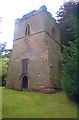
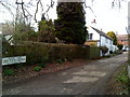
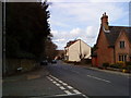
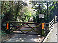
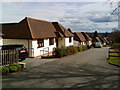
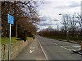
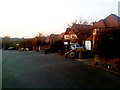
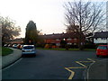
100 photos from this area
Area Information
Key information about the NG9 3DH including its size, population, and administrative classification.
- Area Type
- Postcode
- Area Size
- 3.9 hectares
- Population
- 1300
- Population Density
- 2339 people/km²
House Prices in NG9 3DH
41
Properties
£399,087
Average Sold Price
£172,500
Lowest Price
£1,260,000
Highest Price
Showing 41 properties
| Address | Type | Beds | Baths | Last Sale Price | Last Sale Date | |
|---|---|---|---|---|---|---|
| 2 Bridle Road, Bramcote, NG9 3DH | Detached | 6 | 4 | £265,000 | Jan 2024 | |
| 23 Bridle Road, Bramcote, NG9 3DH | Detached | 6 | 4 | £1,260,000 | May 2023 | |
| 34 Bridle Road, Bramcote, NG9 3DH | Detached | 6 | 4 | £435,000 | Mar 2021 | |
| 36 Bridle Road, Bramcote, NG9 3DH | Detached | 5 | - | £440,000 | Jan 2021 | |
| 5 Bridle Road, Bramcote, NG9 3DH | Detached | 4 | 3 | £695,000 | Sep 2020 | |
| 7 Bridle Road, Bramcote, NG9 3DH | Detached | 6 | 4 | £900,000 | Jun 2019 | |
| 17A Bridle Road, Bramcote, NG9 3DH | Detached | 4 | 2 | £506,000 | Feb 2018 | |
| 24 Bridle Road, Bramcote, NG9 3DH | Bungalow | 2 | 1 | £275,000 | Mar 2016 | |
| 8 Bridle Road, Bramcote, NG9 3DH | Bungalow | 3 | - | £345,000 | Jan 2015 | |
| 15 Bridle Road, Bramcote, NG9 3DH | Detached | 3 | - | £391,000 | Aug 2014 |
Page 1 of 5
Energy Efficiency in NG9 3DH
Amenities
Schools
| Rank | School | Type | Entry gender | Ages |
|---|
Explore more schools in this area
Go to Schools tabDemographics
Household Size
Two person
most common
Accommodation Type
Houses
most common
Tenure
92
majority
Ethnic Group
White
most common
Religion
N/A
most common
Household Composition
N/A
most common
Age
47
median
Adults (30-64 years)
most common
Household Deprivation
N/A
with no deprivation
NS-SEC
54
in Lower managerial occupations
Explore more demographic insights in this area
Go to Demographics tabPlanning
Planning Constraints
- Flood RiskPremium
- Ramsar Wetland SitesPremium
- Area of Outstanding Natural BeautyPremium
- Protected Nature ReservePremium
- Protected WoodlandPremium