Area Overview for NG9 3BS
Photos of NG9 3BS
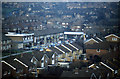
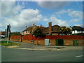
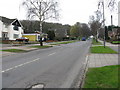
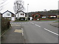
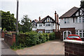
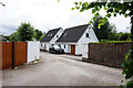
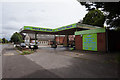
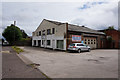
62 photos from this area
Area Information
Key information about the NG9 3BS including its size, population, and administrative classification.
- Area Type
- Postcode
- Area Size
- 1.6 hectares
- Population
- 1258
- Population Density
- 4276 people/km²
House Prices in NG9 3BS
20
Properties
£121,667
Average Sold Price
£33,000
Lowest Price
£225,000
Highest Price
Showing 20 properties
| Address | Type | Beds | Baths | Last Sale Price | Last Sale Date | |
|---|---|---|---|---|---|---|
| 15 Sandgate, Beeston, NG9 3BS | Bungalow | 2 | 1 | £225,000 | Apr 2025 | |
| 12 Sandgate, Beeston, NG9 3BS | Semi-detached | 2 | 1 | £190,000 | Mar 2025 | |
| 16 Sandgate, Beeston, NG9 3BS | Semi-detached | 3 | 1 | £185,000 | Mar 2022 | |
| 14 Sandgate, Beeston, NG9 3BS | Detached | 3 | 1 | £152,500 | Jul 2018 | |
| 20 Sandgate, Beeston, NG9 3BS | Terraced | 2 | 1 | £139,000 | Jun 2018 | |
| 24 Sandgate, Beeston, NG9 3BS | Terraced | 2 | - | £105,000 | Sep 2013 | |
| 2 Sandgate, Beeston, NG9 3BS | Terraced | 4 | 1 | £145,000 | Feb 2007 | |
| 11 Sandgate, Beeston, NG9 3BS | Detached | - | - | £119,999 | Jun 2005 | |
| 22 Sandgate, Beeston, NG9 3BS | Terraced | - | - | £33,000 | Aug 2002 | |
| 5 Sandgate, Beeston, NG9 3BS | Bungalow | - | - | £76,000 | May 2002 |
Page 1 of 2
Energy Efficiency in NG9 3BS
Amenities
Schools
| Rank | School | Type | Entry gender | Ages |
|---|
Explore more schools in this area
Go to Schools tabDemographics
Household Size
One person
most common
Accommodation Type
Houses
most common
Tenure
60
majority
Ethnic Group
White
most common
Religion
N/A
most common
Household Composition
N/A
most common
Age
47
median
Adults (30-64 years)
most common
Household Deprivation
N/A
with no deprivation
NS-SEC
40
in Lower managerial occupations
Explore more demographic insights in this area
Go to Demographics tabPlanning
Planning Constraints
- Flood RiskPremium
- Ramsar Wetland SitesPremium
- Area of Outstanding Natural BeautyPremium
- Protected Nature ReservePremium
- Protected WoodlandPremium