Area Overview for NG9 2UB
Photos of NG9 2UB
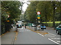
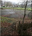
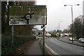
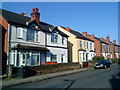
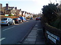
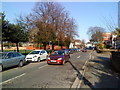
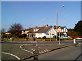
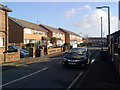
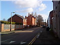
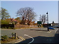
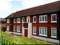
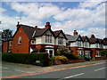
Area Information
NG9 2UB is a specific postcode area covering a small residential cluster within Nottingham, England. The population stands at 2,006 residents, creating a intimate community environment where neighbours likely know one another. Living in NG9 2UB offers a distinct experience characterised by its compact nature, which fosters a close-knit atmosphere. Daily life here revolves around proximity, with essential services and transport links situated within practical reach. This location serves as a residential hub for young adults and professionals seeking a manageable neighbourhood size. The area provides a focused setting where residents can navigate their local environment efficiently. Homes in NG9 2UB benefit from immediate access to major retail parks and transport interchange points. The compact footprint means you do not have to travel far for your daily needs. This postcode functions as a convenient base for those who prefer shorter commutes. You can access key destinations quickly while enjoying a neighbourhood that maintains a distinct identity. The area balances residential quiet with the convenience of being near significant transport nodes. Living in NG9 2UB means prioritising neighbourhood scale alongside accessibility to wider city amenities.
- Area Type
- Postcode
- Area Size
- Not available
- Population
- 2006
- Population Density
- 8864 people/km²
The property market in NG9 2UB is characterised by a substantial owner-occupier base. Data indicates that home ownership levels stand at 56%, which places this postcode ahead of many national averages for rental-dominated zones. This level of ownership suggests a strong attachment to the area by current residents. Houses represent the primary accommodation type within the residential cluster, defining the structural character of the neighbourhood. This focus on detached or semi-detached houses distinguishes it from areas dominated by flats or blocks of apartments. You are looking at a market where independent homes hold significant weight. The relatively small population of 2,006 implies limited inventory at any given time, necessitating a proactive approach if you wish to purchase. This area is not a typical high-density rental block but a traditional housing market. The prevalence of houses aligns with the high home ownership statistic, reinforcing the idea that these are family-sized or investment properties. For buyers, this means competition for specific houses in NG9 2UB may be fierce. The market reflects the stability of a community where residents choose to stay rather than rent.
House Prices in NG9 2UB
No properties found in this postcode.
Energy Efficiency in NG9 2UB
Residents of NG9 2UB enjoy convenient access to a variety of amenities within practical reach. Retail options include Sainsburys Beeston, Co-op Nottingham, and Lidl Beeston, providing comprehensive grocery and shopping needs. These specific venues ensure you can stock up on essentials without leaving the local region. Public transport connectivity is supported by five metro-linked stations, including Middle Street, University Boulevard Tram Stop, and the Bus & Tram Interchange. This network facilitates easy travel across Nottingham and beyond. You have access to five railway stations, such as Beeston Railway Station, Attenborough Railway Station, and Nottingham Railway Station, for faster regional connections. One airport, Nottingham Airport, is also listed within the practical reach of the postcode. This concentration of transport and retail nodes means daily errands and commutes are streamlined. The presence of major supermarkets supports a self-contained lifestyle where major trips are rare. Living in NG9 2UB provides the convenience of big-city shopping and transport without the density of the city centre.
Amenities
Schools
Education facilities within reach of NG9 2UB include Dagfa School Nottingham. This institution operates as an independent school, offering a specific type of educational path for children in the area. The presence of an independent school implies options for parents seeking alternative curricula or teaching styles managed outside the state system. This school type differs markedly from maintained comprehensive or primary schools. Families living in NG9 2UB have access to this private educational environment without needing to travel to the wider city for schooling. The availability of independent education in the immediate vicinity supports a broad range of family choices. While the data lists only one nearby school, this name confirms the presence of higher-tier educational provision close to the postcode. You can expect a community with access to specialised schooling options. The inclusion of an independent school signals that the local geography supports diverse educational aspirations. This fact is valuable for anyone evaluating schools near NG9 2UB for their children.
| Rank | School | Type | Entry gender | Ages |
|---|
Explore more schools in this area
Go to Schools tabDemographics
The community in NG9 2UB is defined by a young demographic profile with a median age of 22 years. The most common age range consists of young adults between 15 and 29 years old. This concentration of younger residents suggests the area attracts students or early-career professionals. Home ownership reaches a level of 56% within this postcode, indicating a strong property investment culture among the populace. Houses form the predominant accommodation type, shaping the architectural landscape and suburban feel of the neighbourhood. The majority of the population identifies as White, reflecting the established demographic makeup of the area. These concrete figures paint a picture of a youthful, mixed-tenure community. The high rate of home ownership suggests stability and a desire for long-term settlement among residents. You will find a neighbourhood where young adults have either secured their own properties or are moving towards that goal. The demographic data confirms this is not a transient housing estate but a settled residential zone. With over half of households owning their homes, the area possesses a degree of established residency typical of growing suburban clusters. This composition provides a straightforward understanding of the local population without ambiguity.
Household Size
Accommodation Type
Tenure
Ethnic Group
Religion
Household Composition
Age
Household Deprivation
NS-SEC
Explore more demographic insights in this area
Go to Demographics tabPlanning
Planning Constraints
- Flood RiskPremium
- Ramsar Wetland SitesPremium
- Area of Outstanding Natural BeautyPremium
- Protected Nature ReservePremium
- Protected WoodlandPremium