Area Overview for NG9 2SD
Photos of NG9 2SD
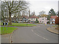
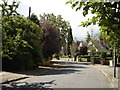
100 photos from this area
Area Information
Key information about the NG9 2SD including its size, population, and administrative classification.
- Area Type
- Postcode
- Area Size
- 1.8 hectares
- Population
- 4950
- Population Density
- 3972 people/km²
House Prices in NG9 2SD
24
Properties
£100,995
Average Sold Price
£40,500
Lowest Price
£143,000
Highest Price
Showing 24 properties
| Address | Type | Beds | Baths | Last Sale Price | Last Sale Date | |
|---|---|---|---|---|---|---|
| 29 Woodside Road, Nottingham, NG9 2SD | house | 4 | 1 | £140,000 | Feb 2021 | |
| 57 Woodside Road, Nottingham, NG9 2SD | Terraced | 2 | 1 | £143,000 | Sep 2020 | |
| 67 Woodside Road, Nottingham, NG9 2SD | house | - | - | £110,000 | Jul 2018 | |
| 33 Woodside Road, Nottingham, NG9 2SD | Terraced | 3 | 1 | £140,000 | Feb 2018 | |
| 27 Woodside Road, Nottingham, NG9 2SD | Terraced | 3 | 2 | £93,500 | Oct 2014 | |
| 25 Woodside Road, Nottingham, NG9 2SD | Terraced | 2 | - | £95,000 | Sep 2014 | |
| 47 Woodside Road, Nottingham, NG9 2SD | Terraced | 2 | 1 | £105,000 | May 2013 | |
| 39 Woodside Road, Nottingham, NG9 2SD | Terraced | - | - | £97,000 | May 2006 | |
| 31 Woodside Road, Nottingham, NG9 2SD | house | 3 | 1 | £40,500 | Jul 1998 | |
| 53 Woodside Road, Nottingham, NG9 2SD | Terraced | 3 | 1 | £45,950 | May 1998 |
Page 1 of 3
Energy Efficiency in NG9 2SD
Amenities
Schools
| Rank | School | Type | Entry gender | Ages |
|---|
Explore more schools in this area
Go to Schools tabDemographics
Household Size
Two person
most common
Accommodation Type
Houses
most common
Tenure
32
majority
Ethnic Group
White
most common
Religion
N/A
most common
Household Composition
N/A
most common
Age
22
median
Young Adults (15-29 years)
most common
Household Deprivation
N/A
with no deprivation
NS-SEC
10
in Lower managerial occupations
Explore more demographic insights in this area
Go to Demographics tabPlanning
Planning Constraints
- Flood RiskPremium
- Ramsar Wetland SitesPremium
- Area of Outstanding Natural BeautyPremium
- Protected Nature ReservePremium
- Protected WoodlandPremium