Area Overview for NG9 2PA
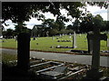
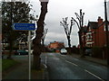
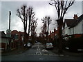
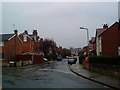
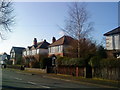
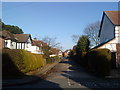
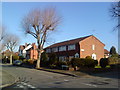
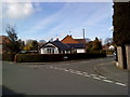
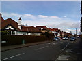
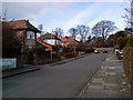
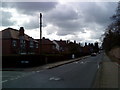
Photos of NG9 2PA

Area Information
The NG9 2PA postcode covers a specific residential cluster in Nottinghamshire, encompassing 1.8 hectares within a small community of 2,159 people. This compact footprint sits on some of the most densely packed land in England, hosting a population density exceeding 122,000 people per square kilometre. Despite the tight concentration, the area functions as a distinct residential pocket with clear boundaries. Daily life here is defined by proximity; residents navigate a neighbourhood where space is at a premium yet local services remain within practical reach. The sheer number of people living in such a small space creates a tightly knit environment where neighbours likely interact frequently within the immediate vicinity. Living in NG9 2PA means accepting this high density in exchange for the convenience of having amenities close by without needing to travel far. The area represents a micro-community where the volume of residents is significant relative to the physical land available.
- Area Type
- Postcode
- Area Size
- 1.8 hectares
- Population
- Not available
- Population Density
- Not available
Homes in NG9 2PA are primarily houses, accounting for almost all of the local housing stock. You will find very few flats or apartments in this specific postcode sector, confirming a market dedicated to traditional family homes. Just over half of the residents own their properties outright or have a mortgage, while the remainder reside in rented accommodation. This 51% ownership rate suggests a balanced market where neither buying nor renting overwhelmingly dominates, yet a majority of long-term residents choose to buy into the area. The density of the neighbourhood means that properties are likely situated close together, typical of the high occupancy rates found across this hectare-sized cluster. Buyers looking here should expect a inventory focused on existing stock rather than new builds or conversions. The absence of flat developments indicates a lack of interest or planning permission for high-rise or multi-unit living within these boundaries. For those seeking the traditional garden lifestyle associated with houses, this postcode offers limited options compared to areas with lower density. The housing profile is consistent with the age demographic of 47 years, favouring family-sized properties over studios or one-bed flats.
House Prices in NG9 2PA
Showing 65 properties
| Address | Type | Beds | Baths | Last Sale Price | Last Sale Date | |
|---|---|---|---|---|---|---|
| Gilbert And Hall Ltd, Attenborough House, 1-3 Albion Street, Beeston, NG9 2PA | Detached | 1 | 9 | £342,000 | Feb 2023 | |
| 1, Albion House, Albion Street, Beeston, NG9 2PA | Office | - | - | - | - | |
| 27, Pollard Court, Albion Street, Beeston, NG9 2PA | Flat | - | - | - | - | |
| 33, Pollard Court, Albion Street, Beeston, NG9 2PA | Flat | - | - | - | - | |
| 38, Pollard Court, Albion Street, Beeston, NG9 2PA | Flat | - | - | - | - | |
| 3, Pollard Court, Albion Street, Beeston, NG9 2PA | Flat | - | - | - | - | |
| 22, Pollard Court, Albion Street, Beeston, NG9 2PA | Flat | - | - | - | - | |
| 10, Pollard Court, Albion Street, Beeston, NG9 2PA | Flat | - | - | - | - | |
| 12, Pollard Court, Albion Street, Beeston, NG9 2PA | Flat | - | - | - | - | |
| 17, Pollard Court, Albion Street, Beeston, NG9 2PA | Flat | - | - | - | - |
Energy Efficiency in NG9 2PA
Living in NG9 2PA places you within practical reach of significant retail and transport hubs in the wider Nottingham region. For shopping needs, Sainsburys Beeston, Lidl Beeston, and Tesco Nottingham are available nearby, covering your requirements for groceries and household essentials. Public transport connections allow you to travel via the Bus & Tram Interchange, Beeston Centre Tram Stop, and Middle Street, providing flexibility for commuting. Three railway stations sit close by, including Beeston Railway Station, Attenborough Railway Station, and Nottingham Railway Station, offering direct links to the city centre and beyond. Nottingham Airport is located within a reasonable distance for occasional travel or business trips. This concentration of amenities within a short commute compensates for the compact size of your local neighbourhood. You can combine a quiet residential life with easy access to the vibrancy of larger city centres. The presence of five major retail locations and five transport nodes nearby ensures that daily errands do not require lengthy journeys. Residents benefit from the economies of scale in nearby Beeston, accessing the same facilities without being encumbered by the congestion of the main city.
Amenities
Schools
Families living in NG9 2PA have access to Round Hill Primary School, which serves as the sole educational facility listed for the immediate vicinity of the postcode. This road school holds an Ofsted rating of 'good', indicating a standard level of educational quality suitable for local children. The availability of only one primary school suggests that residents must look slightly further afield or share this institution with neighbours in surrounding postcodes for secondary education. Younger children in the area will attend Round Hill, while older students will need to travel to comprehensive schools in broader Nottinghamshire or Derbyshire locations. The single option for primary education means that demand for places exists in a constrained environment typical of small clusters. Parents considering this area should verify the catchment boundaries for Round Hill Primary School against their specific home address, as small postcode sectors often have strict allocation rules. The 'good' rating provides reassurance, though waiting lists for popular local primaries are common even in areas without 'outstanding' ratings. Education remains a key consideration for adult residents, given the median age of 47 years which often coincides with school-aged children.
| Rank | School | Type | Entry gender | Ages |
|---|
Explore more schools in this area
Go to Schools tabDemographics
The community in NG9 2PA is dominated by adults between the ages of 30 and 64, with a median age of 47 years. This profile indicates a neighbourhood where families with older children or adults approaching retirement reside, rather than a hub for young professionals or students. House ownership stands at 51%, meaning slightly more than half of the residents have bought their homes while the majority engage in some form of renting arrangement. Almost all accommodation consists of houses, suggesting a preference for single-family dwellings over flats or apartments within this specific postcode sector. The predominant ethnic group is White, reflecting the broader demographic landscape of the local region. The low median age relative to other parts of the country suggests a stable, settled population with long-term ties to Nottinghamshire. These figures point to a mature neighbourhood where stability is the norm and household composition tends toward established family units or individuals with settled lives. Two-thirds of the population falls into the prime working age bracket.
Household Size
Accommodation Type
Tenure
Ethnic Group
Religion
Household Composition
Age
Household Deprivation
NS-SEC
Explore more demographic insights in this area
Go to Demographics tabPlanning
Planning Constraints
- Flood RiskPremium
- Ramsar Wetland SitesPremium
- Area of Outstanding Natural BeautyPremium
- Protected Nature ReservePremium
- Protected WoodlandPremium