Area Overview for NG9 2JJ
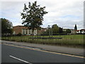
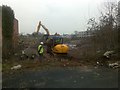
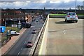
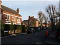
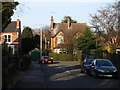
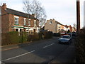
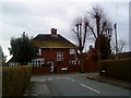
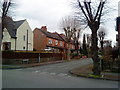
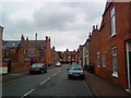
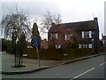
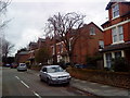
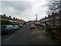
Photos of NG9 2JJ
Area Information
NG9 2JJ is a small, tightly defined residential cluster within Nottinghamshire, covering just 2,608 square metres. Despite its modest footprint, the postcode serves 2,159 residents, creating a sleeping density of approximately 827,936 people per square kilometre according to current records. This high density figure reflects the specific data capture for this limited geography rather than traditional housing spread. Life here centres on close proximity to major transport hubs, including the Beeston Centre Tram Stop and nearby railway stations. The area functions as a compact node within a larger urban fabric, offering direct access to the broader Nottingham commuter network. Living in NG9 2JJ means navigating a small postcode that connects immediately to Beeston and central Nottingham. Residents benefit from immediate practical reach to essential services found just outside this specific boundary. The location sits near Nottingham Airport, providing convenient international and regional links. Daily life is shaped by this strategic position at the intersection of transport lines. The area demonstrates a functional utility despite its small geographic size, positioning it as a practical choice for those prioritising connectivity over open space. You will find yourself surrounded by significant infrastructure, making commutes efficient and daily errands manageable. The character of NG9 2JJ is defined by its status as a designated residential cluster with strong external links.
- Area Type
- Postcode
- Area Size
- 2608 m²
- Population
- Not available
- Population Density
- Not available
The property market in NG9 2JJ is characterised by a slight edge towards owner occupancy, with 51% of homes owned versus 49% rented. Houses remain the primary accommodation type, which dictates the overall look and feel of the streets. This skew towards ownership often signals a stable, family-oriented environment where residents invest in their immediate surroundings. Buyers should note that you are dealing with a small residential cluster of just 2,608 square metres, which limits the variety of property types available directly within the postcode boundary. Because houses dominate the stock, you will likely encounter semi-detached or detached properties rather than high-rise blocks or studio flats. The 51% ownership rate suggests a thriving private rental market for the remaining nearly half of the residents. This balance means competition for better properties can be fierce among buyers looking to enter the market. If you are considering homes in NG9 2JJ, focus on structural details typical of the area, such as extensions or garden sizes, as these are common features of the local housing stock. The small size of the area means inventory will be low, but the high ownership rate indicates good maintenance standards among those who own their dwellings. Potential buyers should prepare for a market where long-term residents dominate the listings. The combination of house types and ownership levels creates a straightforward, if competitive, landscape for anyone seeking to move here.
House Prices in NG9 2JJ
Showing 3 properties
| Address | Type | Beds | Baths | Last Sale Price | Last Sale Date | |
|---|---|---|---|---|---|---|
| Explore Learning, 33-34 The Square, Beeston, NG9 2JJ | office_workshop | - | - | - | - | |
| Public Conveniences, Styring Street, Beeston, NG9 2JJ | commercial | - | - | - | - | |
| Willsuite, 33A The Square, Beeston, NG9 2JJ | Office | - | - | - | - |
Energy Efficiency in NG9 2JJ
Residents of NG9 2JJ enjoy immediate access to a diverse range of amenities within practical reach. For retail needs, you can shop at Tesco Nottingham, Sainsburys Beeston, and Lidl Beeston. These supermarkets offer everything from daily groceries to household essentials, reducing the need for extended travel. The area also benefits from significant transport infrastructure, with Bus & Tram Interchange, Beeston Centre Tram Stop, and Tram& Bus Interchange located nearby. These hubs facilitate easy journeys to central Nottingham and beyond. Transport options extend to rail travel via Beeston Railway Station, Attenborough Railway Station, and Nottingham Railway Station. This variety ensures you are not dependent on a single line for your daily commute. Nottingham Airport is just one stop away, adding rare convenience for business travelers or leisure tourists. The presence of these major amenities within the cluster means you enjoy urban convenience with fewer journey times. You might walk to a supermarket or catch a tram to a concert or appointment without a car. The lifestyle here is defined by convenience and direct access to city centre resources. Living in NG9 2JJ positions you centrally within a network of commerce and transport, allowing you to maximise free time for leisure and family. The concentration of retail and transit options creates a self-sufficient environment where daily needs are met quickly and efficiently.
Amenities
Schools
Educational provision for children near NG9 2JJ includes Round Hill Primary School, which holds a 'good' Ofsted rating. This is the only school listed in the available data for this postcode area. Round Hill Primary School serves the younger demographic, typically from early years to age 11, fitting squarely into the area's active adult and family profile. For families with older children, the current dataset does not list secondary schools directly attached to this small cluster. However, the presence of a rated primary school indicates that the local education authority prioritises early childhood and primary education standards here. Living in NG9 2JJ provides you with access to a school that satisfies government standards for teaching quality and student well-being. The 'good' rating gives confidence in the educational foundation laid in the early years. If you have children who have finished primary education, you may need to look at surrounding areas in Beeston or Nottingham for secondary options, as the data only confirms the existence of Round Hill for this specific cluster. The proximity to a good-rated primary school is a significant asset for households with young children living in this postcode. It ensures that schooling starts strong locally before transitions to other institutions become necessary.
| Rank | School | Type | Entry gender | Ages |
|---|
Explore more schools in this area
Go to Schools tabDemographics
The community in NG9 2JJ is dominated by adults, with the most common age range falling between 30 and 64 years. The median age for residents is 47, indicating a mature population settled in long-term housing. Home ownership stands at 51%, meaning slightly more than half of the local population owns their property outright or with a mortgage. The remaining residents are likely tenants or young professionals finding their footing in the market. Houses form the predominant accommodation type, shaping the visual and functional identity of the neighbourhood. This stock suggests a preference for traditional living arrangements rather than flats or purpose-built rental developments. The area is predominantly White, reflecting the ethnic composition recorded in recent surveys. Understanding these demographics helps you picture the people around you. The age profile suggests a stable environment where families and working professionals coexist alongside retirees. The high percentage of adults over 30 correlates with the ownership figures, painting a picture of a settled community. You are looking at an area where a majority have weathered the economic ups and downs of the past decade to secure a home. The housing stock and age data work together to show a resident base focused on stability rather than short-term lets or student housing.
Household Size
Accommodation Type
Tenure
Ethnic Group
Religion
Household Composition
Age
Household Deprivation
NS-SEC
Explore more demographic insights in this area
Go to Demographics tabPlanning
Planning Constraints
- Flood RiskPremium
- Ramsar Wetland SitesPremium
- Area of Outstanding Natural BeautyPremium
- Protected Nature ReservePremium
- Protected WoodlandPremium