Area Overview for NG9 2JD
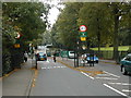
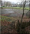
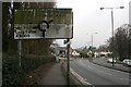
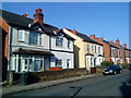
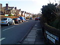
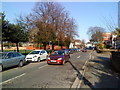
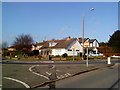
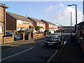
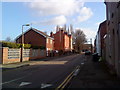
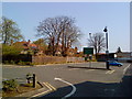
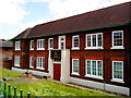
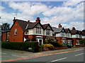
Photos of NG9 2JD
Area Information
Living in NG9 2JD means residing within a specific residential cluster that covers an area of 3,681 square metres. This small postcode serves 2,006 people, creating a compact neighbourhood with a high density of 544,910 people per square kilometre. The location sits in England and forms part of the wider Nottingham landscape. Daily life here centres on immediate convenience, with access to major transport hubs and retail stores just beyond the small residential boundary. You find yourself in a neighbourhood where the physical footprint is limited but the connection to the wider city is direct. The area functions as a gateway to more extensive urban services while maintaining a defined residential identity. Prospective buyers should note that this specific postcode represents a concentrated living environment rather than a sprawling suburb. The population cluster is distinct from surrounding regions, offering a focused experience for those seeking a specific point of contact in the local estate. You thrive here if you prefer a self-contained zone that reaches out quickly to greater Nottingham amenities without the sprawl of larger municipalities.
- Area Type
- Postcode
- Area Size
- 3681 m²
- Population
- 2006
- Population Density
- 8864 people/km²
Homes in NG9 2JD consist primarily of houses, which shapes the character of the housing stock significantly compared to areas dominated by apartments. With a home ownership rate of 56%, the market shows a strong inclination towards owner-occupation, indicating that secure families and long-term residents are established here. This percentage suggests that rental pressure exists but is balanced by a solid base of private homeowners. Given the accommodation type is listed as houses, you will not find large blocks of purpose-built flats in this specific postcode, though nearby areas may offer different choices. The small area size of 3,681 square metres limits the total volume of available properties, meaning competition for specific homes can be intense for those targeting this cluster. Buyers looking at this postcode face a market where houses are the standard expectation rather than alternative dwelling types. The 56% ownership figure also hints at potential equity growth for current owners in a market where house supply is constrained by the physical limits of the small residential cluster. You should expect a stable market for houses, driven by the fact that the majority of the population considers this their permanent home.
House Prices in NG9 2JD
Showing 100 properties
Energy Efficiency in NG9 2JD
Residents of NG9 2JD benefit from excellent access to nearby amenities within practical reach of their daily routines. Retail options include Co-op Nottingham, Sainsburys Beeston, and Lidl Beeston, providing everything from essentials to groceries for the whole family. Transport links are extensive, with the University Boulevard Tram Stop and the Bus & Tram Interchange located nearby, ensuring easy access to Nottingham City Centre. You can also rely on five railway stations including Beeston Railway Station, Attenborough Railway Station, and Nottingham Railway Station for train journeys across the East Midlands. Nottingham Airport sits within a practical distance, facilitating easy travel connections for business or leisure trips. The area offers five metro stops and significant retail choices, creating a lifestyle where you rarely need to drive for basic needs. Dining and shopping are accessible without leaving the immediate vicinity of the larger towns that surround this postcode. The proximity to multiple transport hubs means you can commute from NG9 2JD to major employment hubs with ease. This blend of local convenience and regional connectivity defines the resident experience, offering a balance between suburban comfort and urban accessibility.
Amenities
Schools
Education options for families living near NG9 2JD are anchored by Dagfa School Nottingham, which operates as an independent institution. Being an independent school places it outside the standard comprehensive state system, offering a distinct education model that caters to families seeking private schooling. The independence of Dagfa School Nottingham means it follows a different curriculum structure and admission process than local state maintained schools. While the data contains only this single named school, the presence of an independent provider suggests an area where parents have access to premium educational choices immediately on their doorstep. You do not have secondary public schools listed directly attached to this specific postcode data, so families must look to Dagfa School Nottingham for the only explicitly named educational provision in the immediate vicinity. The type of school available influences the demographic mix, as independent schools often attract families who value specific pedagogical approaches over geographical proximity alone. Prospective homebuyers should consider the distance to this one named school when evaluating the area for children's education. The lack of additional listed schools in the data indicates that the nearest alternatives may be in adjacent postcodes, making Dagfa School Nottingham the primary reference point for local education queries.
| Rank | School | Type | Entry gender | Ages |
|---|
Explore more schools in this area
Go to Schools tabDemographics
The community in NG9 2JD is defined by a population median age of 22 years, confirming that young adults between 15 and 29 years old form the most common age range. This demographic profile indicates a neighbourhood dominated by renters or young households rather than established families with older children. Home ownership stands at exactly 56%, meaning the majority of residents own their properties outright or with a mortgage. The predominant accommodation type consists of houses, suggesting a stock that includes standalone dwellings rather than high-rise flats. The ethnic composition is predominantly White, reflecting the broader demographic trends of the region. With such a young population, the area likely supports a dynamic cultural scene and nightlife focused on students and early career workers. The slight majority of owners contrasts with the young median age, implying that many homeowners may be older renters previously displaced from this zone or long-term residents who have purchased homes as prices became affordable for younger buyers. You should expect a neighbourhood where life begins early, with a significant portion of the 2,006 residents still navigating their twenties and thirties.
Household Size
Accommodation Type
Tenure
Ethnic Group
Religion
Household Composition
Age
Household Deprivation
NS-SEC
Explore more demographic insights in this area
Go to Demographics tabPlanning
Planning Constraints
- Flood RiskPremium
- Ramsar Wetland SitesPremium
- Area of Outstanding Natural BeautyPremium
- Protected Nature ReservePremium
- Protected WoodlandPremium