Area Overview for NG9 2HN
Photos of NG9 2HN
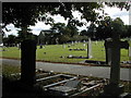
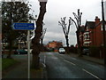
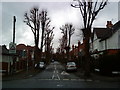

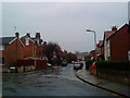
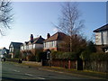
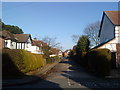
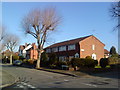
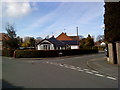
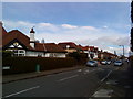
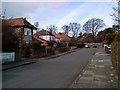
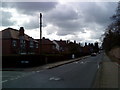
100 photos from this area
Area Information
Key information about the NG9 2HN including its size, population, and administrative classification.
- Area Type
- Postcode
- Area Size
- 9331 m²
- Population
- 2006
- Population Density
- 8864 people/km²
House Prices in NG9 2HN
20
Properties
£187,074
Average Sold Price
£46,250
Lowest Price
£360,150
Highest Price
Showing 20 properties
| Address | Type | Beds | Baths | Last Sale Price | Last Sale Date | |
|---|---|---|---|---|---|---|
| 119 Marlborough Road, Beeston, NG9 2HN | Semi-detached | 3 | 1 | £360,150 | Oct 2025 | |
| 108 Marlborough Road, Beeston, NG9 2HN | Terraced | 3 | 1 | £235,000 | Aug 2024 | |
| 123 Marlborough Road, Beeston, NG9 2HN | Semi-detached | 3 | - | £281,000 | Aug 2023 | |
| 107 Marlborough Road, Beeston, NG9 2HN | Detached | 3 | 1 | £263,000 | May 2023 | |
| 104 Marlborough Road, Beeston, NG9 2HN | Bungalow | 3 | 2 | £247,500 | Jun 2021 | |
| 111 Marlborough Road, Beeston, NG9 2HN | Semi-detached | 3 | 1 | £243,000 | May 2020 | |
| 121 Marlborough Road, Beeston, NG9 2HN | Semi-detached | 3 | 1 | £212,500 | Aug 2019 | |
| 106 Marlborough Road, Beeston, NG9 2HN | Bungalow | 3 | 1 | £135,000 | Oct 2015 | |
| 113 Marlborough Road, Beeston, NG9 2HN | Semi-detached | 3 | - | £150,000 | Jul 2015 | |
| 102 Marlborough Road, Beeston, NG9 2HN | Bungalow | 3 | 1 | £187,500 | Mar 2014 |
Page 1 of 2
Energy Efficiency in NG9 2HN
Amenities
Schools
| Rank | School | Type | Entry gender | Ages |
|---|
Explore more schools in this area
Go to Schools tabDemographics
Household Size
Family (3-5 people)
most common
Accommodation Type
Houses
most common
Tenure
56
majority
Ethnic Group
White
most common
Religion
N/A
most common
Household Composition
N/A
most common
Age
22
median
Young Adults (15-29 years)
most common
Household Deprivation
N/A
with no deprivation
NS-SEC
23
in Lower managerial occupations
Explore more demographic insights in this area
Go to Demographics tabPlanning
Planning Constraints
- Flood RiskPremium
- Ramsar Wetland SitesPremium
- Area of Outstanding Natural BeautyPremium
- Protected Nature ReservePremium
- Protected WoodlandPremium