Area Overview for NG9 2BQ
Photos of NG9 2BQ
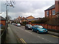
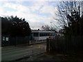
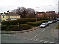
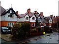
100 photos from this area
Area Information
Key information about the NG9 2BQ including its size, population, and administrative classification.
- Area Type
- Postcode
- Area Size
- 1.0 hectares
- Population
- 1299
- Population Density
- 3327 people/km²
House Prices in NG9 2BQ
42
Properties
£126,157
Average Sold Price
£37,450
Lowest Price
£249,999
Highest Price
Showing 42 properties
| Address | Type | Beds | Baths | Last Sale Price | Last Sale Date | |
|---|---|---|---|---|---|---|
| 6 Alexandra Crescent, Beeston, NG9 2BQ | Semi-detached | 3 | 1 | £249,999 | Apr 2024 | |
| 76 Alexandra Crescent, Beeston, NG9 2BQ | Terraced | 3 | - | £210,000 | Nov 2022 | |
| 66 Alexandra Crescent, Beeston, NG9 2BQ | Terraced | 6 | 2 | £225,000 | Nov 2021 | |
| 2 Alexandra Crescent, Beeston, NG9 2BQ | Terraced | 3 | 2 | £196,000 | Mar 2021 | |
| 72 Alexandra Crescent, Beeston, NG9 2BQ | Terraced | 3 | 1 | £159,950 | Jul 2019 | |
| 70 Alexandra Crescent, Beeston, NG9 2BQ | house | 3 | 1 | £153,000 | Oct 2018 | |
| 56 Alexandra Crescent, Beeston, NG9 2BQ | house | - | - | £38,900 | Jul 2018 | |
| 58 Alexandra Crescent, Beeston, NG9 2BQ | Terraced | 3 | 1 | £137,000 | May 2017 | |
| 84 Alexandra Crescent, Beeston, NG9 2BQ | Semi-detached | 3 | - | £138,000 | Nov 2016 | |
| 16 Alexandra Crescent, Beeston, NG9 2BQ | Terraced | 3 | 1 | £106,000 | Feb 2015 |
Page 1 of 5
Energy Efficiency in NG9 2BQ
Amenities
Schools
| Rank | School | Type | Entry gender | Ages |
|---|
Explore more schools in this area
Go to Schools tabDemographics
Household Size
One person
most common
Accommodation Type
Houses
most common
Tenure
41
majority
Ethnic Group
White
most common
Religion
N/A
most common
Household Composition
N/A
most common
Age
47
median
Adults (30-64 years)
most common
Household Deprivation
N/A
with no deprivation
NS-SEC
34
in Lower managerial occupations
Explore more demographic insights in this area
Go to Demographics tabPlanning
Planning Constraints
- Flood RiskPremium
- Ramsar Wetland SitesPremium
- Area of Outstanding Natural BeautyPremium
- Protected Nature ReservePremium
- Protected WoodlandPremium