Area Overview for NG9 1NT
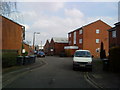
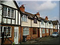
Photos of NG9 1NT


Area Information
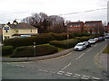
Living in NG9 1NT offers a settled residential experience within a compact zone covering 1,757 square metres. This specific postcode constitutes a small residential cluster with a total population of 1,789 people. The density of 101,793,300 people per square kilometre reflects a tightly packed neighbourhood where daily life revolves around immediate neighbours and local infrastructure. The area serves as a stable environment for households seeking a defined community setting rather than sprawling suburbs. Residential life here is grounded in practicality, with proximity to key transport hubs like Beeston Railway Station and Attenborough Railway Station shaping the daily rhythm for commuters. While the physical footprint is limited, the location provides substantial access to regional amenities including Nottingham Airport and major retail parks. Residents benefit from established services such as Tesco Nottingham and Co-op Queens, which sit within practical reach. The character of NG9 1NT is defined by its function as a home zone for families and professionals who require a balance of local quietness and access to wider city facilities. This postcode represents a concentrated slice of the wider Nottinghamshire settlement, offering a clear sense of place without the anonymity of larger urban districts.
- Area Type
- Postcode
- Area Size
- 1757 m²
- Population
- 1789
- Population Density
- 4109 people/km²
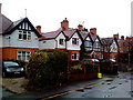
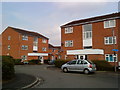
The property market in NG9 1NT is characterised by a strong leaning towards owner-occupied housing. Evidence shows that 62% of residents own their homes, which establishes this postcode as a stable market rather than a high-volume rental hub. The predominant accommodation type is houses, distinguishing it from areas dominated by flats or high-density blocks. This housing stock appeals to families and individuals seeking private gardens and separate entrances rather than shared living spaces. Property buyers looking at NG9 1NT should anticipate a market with established tenure and a clear focus on traditional residential layouts. The small size of the area, covering only 1,757 square metres, limits the sheer volume of available stock compared to larger districts. Consequently, stock turnover may be slower, and competition for specific properties could be keen among local buyers. The high home ownership rate suggests that selling a property here often involves negotiating with long-term residents who understand the local litter and value the quiet atmosphere. Rental demand exists but likely caters to those seeking a pied-à-terre near rail stations or schools. For buyers, the data indicates a reliable, mature market where property values are supported by a base of owners who treat their residences as primary homes rather than investments.
House Prices in NG9 1NT
Showing 3 properties
| Address | Type | Beds | Baths | Last Sale Price | Last Sale Date | |
|---|---|---|---|---|---|---|
| 4 Grassy Lane, Beeston, NG9 1NT | Detached | - | - | £125,000 | May 1999 | |
| 6 Grassy Lane, Beeston, NG9 1NT | Terraced | - | - | - | - | |
| 2 Grassy Lane, Beeston, NG9 1NT | Bungalow | - | - | - | - |
Energy Efficiency in NG9 1NT
Residents of NG9 1NT enjoy practical access to a wide range of amenities within reasonable travelling distance. Five rail stations operate nearby, with Beeston Railway Station, Attenborough Railway Station, and Nottingham Railway Station being the most notable options for longer journeys. Retail provisions include Tesco Nottingham, Co-op Queens, and Co-op Beeston, ensuring that groceries and daily necessities are easily obtainable. Public transport links are equally developed, with five metro services available including the Tram and Bus Interchange, Beeston Centre Tram Stop, and Bus and Tram Interchange. For those requiring air travel, Nottingham Airport stands as a nearby option for regional flights. This extensive network of shops and transport nodes means most daily errands can be completed without needing to travel far beyond the immediate neighbourhood. The presence of major supermarkets like Tesco and Co-op supports the local population of 1,789 people with competitive pricing and variety. TfL transport hubs facilitate easy connection to the rest of the city and beyond. Leisure activities and dining options generally cluster around these main transport and retail nodes. The convenience factor is high, allowing residents to balance local living with easy access to broader regional services.
Amenities
Schools
Families living in NG9 1NT have access to two primary schools with recent Ofsted ratings of good. Beeston Rylands Junior School serves local pupils as a secondary or late primary institution depending on the catchment boundary, while Trent Vale Infant School caters to younger children. Both institutions hold a good rating, indicating they meet the expected standards for education and school environment. This mix of infant and junior provisions allows for a logical progression of schooling within the immediate vicinity. The presence of these two established schools suggests that NG9 1NT falls within or is well-served by the educational infrastructure of the wider Beeston area. Parents in the 30-64 year age group, which forms the core demographic, can expect reputable educational options without needing to travel far to Nottingham city centre. The good rating from Ofsted provides assurance that the curriculum and pastoral care meet government requirements. While comprehensive school data is not listed in the immediate surroundings, the availability of primary education supports families with younger children. The proximity of Beeston Rylands Junior School and Trent Vale Infant School to the 1,789 residents means daily drop-offs and pick-ups occur within a manageable distance for local families.
| Rank | School | Type | Entry gender | Ages |
|---|
Explore more schools in this area
Go to Schools tabDemographics
The community in NG9 1NT is dominated by adults, with the median age standing at 47 years. A significant majority of residents fall into the 30 to 64 year age bracket, indicating a population primarily in their prime working or early retirement years. This age profile suggests the area attracts established households rather than young singles or students. Home ownership rates are solid at 62%, meaning more than five out of every ten residents buy their homes outright or via mortgage. The predominant accommodation type consists of houses, aligning with the preferences of the older, property-owning demographic. The ethnic composition is predominantly White, reflecting the broader demographic trends of the established neighbourhoods surrounding this postcode. These figures paint a picture of a mature community where stability is the norm. With a population of 1,789, interactions likely remain familiar across the 1,757 square metres of land available. The high home ownership figure implies long-term residency and investment in the local environment. Families and couples typically form the largest household units here, consistent with the median age data. The absence of significant student populations or transient workers further cements the area as a place for settled living.
Household Size
Accommodation Type
Tenure
Ethnic Group
Religion
Household Composition
Age
Household Deprivation
NS-SEC
Explore more demographic insights in this area
Go to Demographics tabPlanning
Planning Constraints
- Flood RiskPremium
- Ramsar Wetland SitesPremium
- Area of Outstanding Natural BeautyPremium
- Protected Nature ReservePremium
- Protected WoodlandPremium