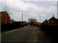
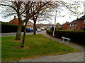
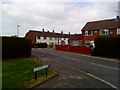
Area Overview for NG9 1NH
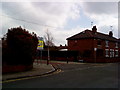
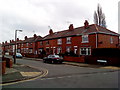
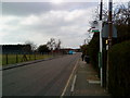
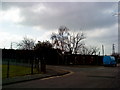
Photos of NG9 1NH

Area Information
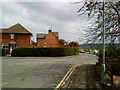
Living in NG9 1NH offers a distinctly compact residential experience. You occupy a very small footprint of 6,018 square metres, home to a population of 1,081 people. This density creates a close-knit environment where neighbours are naturally within sight. The community maintains a population density of 938 people per square kilometre, which emphasises the intimate scale of this postcode area. Daily life here is defined by proximity rather than sprawl. You are part of a specific residential cluster where benefits and drawbacks are felt equally due to the limited physical space. The area functions as a tight community unit rather than a sprawling suburb. Residents navigate short distances for their daily routines within these confines. The character of living in NG9 1NH is shaped by this concentrated population. You share a neighbourhood where every building significantly impacts the local atmosphere. The straightforward nature of the housing estate ensures a clear sense of place without the complexity of mixed-use districts.
- Area Type
- Postcode
- Area Size
- 6018 m²
- Population
- 1081
- Population Density
- 938 people/km²
The property market in NG9 1NH is defined by its singular focus on house ownership. Sixty-seven percent of residents own their homes, creating a landscape where investment buyers dominate over tenants. The accommodation type consists entirely of houses, eliminating the presence of flats or blocks of apartments common in larger urban centres. This structure appeals to buyers seeking privacy, gardens, and detached or semi-detached living. The small footprint of 6,018 square metres limits the total housing stock significantly. You are looking at a micro-market with very few listings available at any given time. The high ownership rate suggests a community where properties often pass down through families rather than cycling rapidly through rental markets. Renters constitute only 33% of the population, reinforcing the idea that this is a buy-to-live location. Homes in NG9 1NH offer a sense of permanence that rental apartments in bigger cities cannot match. You can expect a market driven by established residents rather than speculative investors. The lack of flat options means you must purchase a whole house to live in this area. Future development is strictly limited by the current small physical size of the neighbourhood. If you buy here, you join a tightly held group of proprietors.
House Prices in NG9 1NH
Showing 17 properties
| Address | Type | Beds | Baths | Last Sale Price | Last Sale Date | |
|---|---|---|---|---|---|---|
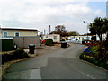
| 6, Lock Close, Riverside Road, Beeston, NG9 1NH | park_home | 1 | 1 | - | - | |
| 17, Lock Close, Riverside Road, Beeston, NG9 1NH | undefined | - | - | - | - | |
| 11, Lock Close, Riverside Road, Beeston, NG9 1NH | Mobile Home | - | - | - | - | |
| 1, Lock Close, Riverside Road, Beeston, NG9 1NH | Mobile Home | - | - | - | - | |
| 2, Lock Close, Riverside Road, Beeston, NG9 1NH | park_home | - | - | - | - | |
| 4, Lock Close, Riverside Road, Beeston, NG9 1NH | Mobile Home | - | - | - | - | |
| 9, Lock Close, Riverside Road, Beeston, NG9 1NH | Mobile Home | - | - | - | - | |
| 15, Lock Close, Riverside Road, Beeston, NG9 1NH | Mobile Home | - | - | - | - | |
| 14, Lock Close, Riverside Road, Beeston, NG9 1NH | Mobile Home | - | - | - | - | |
| 7, Lock Close, Riverside Road, Beeston, NG9 1NH | Mobile Home | - | - | - | - |
Energy Efficiency in NG9 1NH
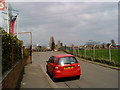
Lifestyle in NG9 1NH revolves around immediate access to essential services and leisure options. Five retail locations are nearest to you, ensuring you never travel far for groceries or daily essentials. You can shop at Co-op Queens in the north or visit Co-op Beeston and Tesco Clifton for other needs. Five railway stations and five metro interchange points are within easy reach for your commute or weekend trips. The Tram and Bus Interchange at Chilwell Road provides centralised public transport access, while the High Road station handles local rail traffic. Beeston and Nottingham Railway Stations offer further connections beyond the immediate cluster. One airport is located nearby, providing direct air links to other cities or international destinations. You live just metres from these transport arteries, saving significant travel time. The presence of five retail outlets suggests a well-served commercial environment despite the residential focus. Convenience is the primary driver of your weekly routine. You do not need a vehicle for short tasks as shops and transport nodes are close by. Daily life blends the quiet of housing with the accessibility of regional transport and retail hubs. Your lifestyle benefits from being situated at the intersection of public transit and key shopping centres.
Amenities
Schools
| Rank | School | Type | Entry gender | Ages |
|---|
Explore more schools in this area
Go to Schools tabDemographics
The community in NG9 1NH is dominated by residents in the 30 to 64 age range. The median age is 47, confirming that majority of households consist of adults rather than young families or retirees. This age profile suggests a stable workforce or established households prioritising stability over rapid growth. Home ownership stands at 67%, indicating that two-thirds of residents have purchased their properties. This high level of ownership creates a settled atmosphere where people have long-term roots in the area. The accommodation type is exclusively houses, meaning you will find no flats or apartments within this cluster. The predominant ethnic group is White, reflecting a homogenous demographic composition typical of many established English suburbs. You are living in an environment built for single-family homes and garden access. The older median age may influence local services or community interests to focus on mature needs. Deprivation data is not provided, so income disparities remain unmeasured in official records for this specific postcode. Your experience is defined by a settled, owner-occupied demographic with a clear generational anchor.
Household Size
Accommodation Type
Tenure
Ethnic Group
Religion
Household Composition
Age
Household Deprivation
NS-SEC
Explore more demographic insights in this area
Go to Demographics tabPlanning
Planning Constraints
- Flood RiskPremium
- Ramsar Wetland SitesPremium
- Area of Outstanding Natural BeautyPremium
- Protected Nature ReservePremium
- Protected WoodlandPremium