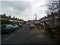
Area Overview for NG9 1FY
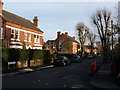
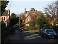
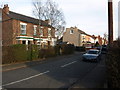
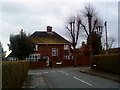
Photos of NG9 1FY


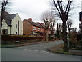
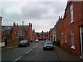
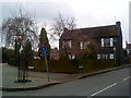
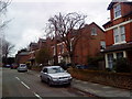
Area Information
Living in NG9 1FY means residing within a very compact residential cluster that covers just 2,607 square metres. This specific postcode serves as a small pocket within the wider Nottingham landscape, hosting a population of 2,159 people. The density here is extremely high, reaching 828,141 people per square kilometre, which suggests a tightly packed neighbourhood where neighbours are often very close by. You will find that daily life revolves around immediate proximity to major transport hubs and retail destinations nearby. The area is defined by its residential nature, yet its physical size creates an environment where services are accessible without long commutes. Residents of NG9 1FY benefit from being situated where large-scale shopping and public transport intersections are just minutes away. This location offers a practical living situation for those who prioritise convenience over expansive gardens or isolated settings. The sheer concentration of population in such a small footprint indicates a mature residential settlement rather than sprawling development. You are part of a community where every local amenity is within practical reach, making this a highly functional homebase.
- Area Type
- Postcode
- Area Size
- 2607 m²
- Population
- Not available
- Population Density
- Not available
The property market in NG9 1FY is distinctly oriented towards house ownership rather than city-centre flats or high-rise apartments. With 51% of homes owned by their occupants, this is a traditional residential area where families seek stability and long-term bases. The accommodation type is predominantly houses, meaning you will find detached, semi-detached, and terraced properties rather than blocks of flats. This housing stock appeals to those who value ground-floor access, private gardens, or established neighbourhood character. Because the postcode covers only 2,607 square metres, the choice of specific properties will be limited within the immediate boundaries, but the surrounding area offers substantial variety. Buyers looking at NG9 1FY should anticipate a market focused on established stock rather than new-build developments. The balance of ownership suggests a stable market with fewer short-term tenants changing landlords frequently. If you are buying a home here, you are likely entering a property chain involving homeowners rather than investor units. The nature of the housing stock implies that renovation projects or extensions may be common rather than apartments requiring concierge services. This area suits buyers who understand the practicalities of house maintenance and community living.
House Prices in NG9 1FY
Showing 2 properties
| Address | Type | Beds | Baths | Last Sale Price | Last Sale Date | |
|---|---|---|---|---|---|---|
| 1, Stevens House The Manor, Church Street, Beeston, NG9 1FY | Flat | 1 | 1 | - | - | |
| 2, Stevens House The Manor, Church Street, Beeston, NG9 1FY | Flat | - | - | - | - |
Energy Efficiency in NG9 1FY
Your lifestyle in NG9 1FY is defined by immediate access to major retail, transport, and convenience hubs. Beeston Centre Tram Stop and the Tram & Bus Interchange are within practical reach, allowing you to travel quickly to other parts of the city. Nearby Retalis offerings include Tesco Nottingham, Sainsburys Beeston, and Co-op Beeston, ensuring you can shop for groceries or pick up essentials without driving far. Beeston Railway Station and Attenborough Railway Station provide regular train services to Nottingham and beyond, while Nottingham Railway Station offers further connections. You are also just one stop away from Nottingham Airport, should you need to travel domestically or internationally. This density of amenities means your daily errands, leisure trips, and important business meetings are all manageable within a short distance. The area supports a routine where you shop, eat, and travel without long waits or significant journey times. For residents, this proximity creates a self-sufficient environment where local services complement the residential facilities of NG9 1FY. You can walk or take a short bus ride to grab lunch, attend a casual event, or catch a train without needing a car for basic tasks. The availability of these five metro, retail, and rail points ensures that living here does not mean isolation from the city's main activities.
Amenities
Schools
Families residing in NG9 1FY have access to quality education nearby. There is one primary school directly associated with the area: Round Hill Primary School. This institution holds a 'good' Ofsted rating, indicating that it meets the standards set by the Department for Education for teaching and student care. The presence of a highly rated primary school suggests that educational outcomes in the catchment area are solid. As the area consists mainly of houses with a median age of 47, you will find many households with young children attending this local institution. There are no secondary schools listed in the immediate data for this specific postcode, so families often travel to neighbouring towns for older children's education. The proximity of these educational facilities supports decisions for those moving into NG9 1FY for their children's schooling. If a child requires special needs support or advanced academic challenges, a 'good' rating provides a baseline, though parents should research specific specialisms separately. The school environment contributes to the community feel, as schools often act as community hubs where local families interact regularly. Choosing a home near Round Hill Primary School ensures your children can attend a regulated, inspected organisation without long journeys.
| Rank | School | Type | Entry gender | Ages |
|---|
Explore more schools in this area
Go to Schools tabDemographics
The community in NG9 1FY is characterised by a mature age profile, with a median age of 47 years. Most residents fall into the adult category, specifically those aged between 30 and 64 years. This demographic indicates a neighbourhood established by families, professionals, and settled individuals rather than young students or empty-nesters. Home ownership stands at 51%, meaning roughly half of the households have bought their property outright or via a mortgage. The other portion of the local population likely rents or shares accommodation. Predominantly, the area consists of houses, which aligns with the ownership statistics. The resident population is mostly White, reflecting the established nature of many UK suburban towns. While the data does not provide figures on deprivation, the low flood risk score of 0 confirms that environmental safety is not a primary concern for quality of life here. The high population density means that community facilities are typically well-utilised. You can expect a stable, family-oriented environment where residents have lived for considerable periods. The age range suggests strong school attendance nearby, reinforcing the area's suitability for those in the middle stages of their lives.
Household Size
Accommodation Type
Tenure
Ethnic Group
Religion
Household Composition
Age
Household Deprivation
NS-SEC
Explore more demographic insights in this area
Go to Demographics tabPlanning
Planning Constraints
- Flood RiskPremium
- Ramsar Wetland SitesPremium
- Area of Outstanding Natural BeautyPremium
- Protected Nature ReservePremium
- Protected WoodlandPremium