Area Overview for NG8 6FU
Photos of NG8 6FU
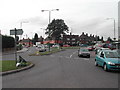
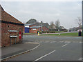
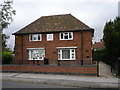
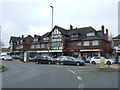
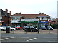
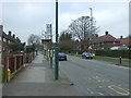
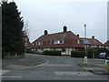
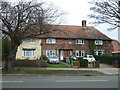
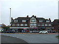
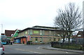
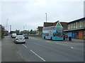
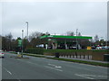
37 photos from this area
Area Information
Key information about the NG8 6FU including its size, population, and administrative classification.
- Area Type
- Postcode
- Area Size
- 1.2 hectares
- Population
- 1744
- Population Density
- 8044 people/km²
House Prices in NG8 6FU
44
Properties
£115,833
Average Sold Price
£60,000
Lowest Price
£155,000
Highest Price
Showing 44 properties
| Address | Type | Beds | Baths | Last Sale Price | Last Sale Date | |
|---|---|---|---|---|---|---|
| 65 Fenwick Road, Nottingham, NG8 6FU | Terraced | 3 | 1 | £153,000 | Aug 2025 | |
| 92 Fenwick Road, Nottingham, NG8 6FU | Semi-detached | 3 | 1 | £150,000 | Mar 2024 | |
| 50 Fenwick Road, Nottingham, NG8 6FU | Semi-detached | 3 | 1 | £155,000 | Mar 2022 | |
| 48 Fenwick Road, Nottingham, NG8 6FU | house | - | - | £112,000 | Sep 2020 | |
| 58 Fenwick Road, Nottingham, NG8 6FU | house | - | - | £65,000 | Jan 2014 | |
| 83 Fenwick Road, Nottingham, NG8 6FU | Semi-detached | 3 | 1 | £60,000 | Jun 2004 | |
| 62 Fenwick Road, Nottingham, NG8 6FU | Terraced | 3 | 1 | - | - | |
| 45 Fenwick Road, Nottingham, NG8 6FU | Semi-detached | 3 | - | - | - | |
| 53 Fenwick Road, Nottingham, NG8 6FU | house | - | - | - | - | |
| 63 Fenwick Road, Nottingham, NG8 6FU | house | - | - | - | - |
Page 1 of 5
Energy Efficiency in NG8 6FU
Amenities
Schools
| Rank | School | Type | Entry gender | Ages |
|---|
Explore more schools in this area
Go to Schools tabDemographics
Household Size
Family (3-5 people)
most common
Accommodation Type
Houses
most common
Tenure
26
majority
Ethnic Group
White
most common
Religion
N/A
most common
Household Composition
N/A
most common
Age
47
median
Adults (30-64 years)
most common
Household Deprivation
N/A
with no deprivation
NS-SEC
12
in Lower managerial occupations
Explore more demographic insights in this area
Go to Demographics tabPlanning
Planning Constraints
- Flood RiskPremium
- Ramsar Wetland SitesPremium
- Area of Outstanding Natural BeautyPremium
- Protected Nature ReservePremium
- Protected WoodlandPremium