Area Overview for NG8 5AF
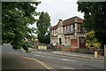
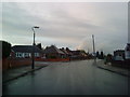
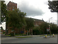
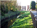
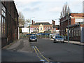
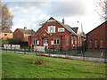
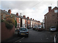
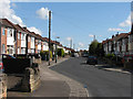
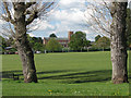
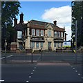
Photos of NG8 5AF


Area Information
Living in NG8 5AF means residing within a precisely defined residential cluster of just 6,325 square metres. This specific postcode serves a tight-knit population of 1,979 people, creating an environment where neighbours are likely to be familiar faces. The area functions as a small pocket within the wider Nottinghamshire landscape, offering a sense of locality rather than sprawling suburbia. Daily life here revolves around this concentrated community, where the high population density means facilities are often within immediate walking distance. You will find yourself surrounded by peers, with the majority of residents being adults aged between 30 and 64 years. The accommodation is dominated by houses, giving the streets a traditional suburban character rather than an urban high-rise feel. While the area is humble in its size, the concentration of residents drives a vibrant local commerce scene. Shopping, and daily errands are managed efficiently due to the proximity of major retailers. The postcode is well integrated with the city's transport network, ensuring that despite its small footprint, access to wider Nottingham is never an issue. You gain a home in a space that balances density with stability, avoiding the chaos of major thoroughfares while remaining connected to essential services. This layout suits those who value a quiet postcode but require quick access to the city centre or airport. The environment reflects a practical choice for buyers seeking a stable address with minimal logistical friction.
- Area Type
- Postcode
- Area Size
- 6325 m²
- Population
- 1979
- Population Density
- 4928 people/km²
NH8 5AF presents a distinct property market scenario characterised by a strong preference for owner-occupation. With 56% of residents owning their homes, the housing stock is primarily composed of houses. This high rate of ownership transforms the local feel into that of a resident neighbourhood rather than a rental estate. You are dealing with a market where sellers are often people who have lived here for years, leading to more informed decision-making during financial negotiations. The dominance of houses over flats or apartments defines the physical appearance of the postcode and dictates the typical buyer profile. If you are looking for homes in this area, expect to find detached or semi-detached structures rather than high-density developments. This structure supports a market driven by families and professionals seeking stability across the 30 to 64 age range. The small size of the cluster means inventory turnover may be slower, but the quality of tenure is generally high. Buying here means joining a community of investors and long-term residents who value asset retention. There is a scarcity of rental properties, suggesting that land and housing supply are largely controlled by owner-occupiers. This dynamic protects values, as the owners have a direct stake in maintaining the area's appeal. You should expect a market that rewards those willing to engage with local, established homeowners rather than face-off committees or tenant agencies.
House Prices in NG8 5AF
No properties found in this postcode.
Energy Efficiency in NG8 5AF
Your daily lifestyle in NG8 5AF is anchored by a diverse range of amenities within immediate reach. Retail options are plentiful, with five major supermarkets located nearby, including Tesco Alfreton, Aldi Hyson, and Asda Hyson. You can stock up on groceries daily without needing a long car journey. Beyond food shopping, the area is woven into the city's transport spine, offering five metro stops like Shipstone Street Tram Stop for easy access to cultural events in the city centre. Transport links also extend to the airport, ensuring business travel or holiday trips are straightforward. For those who prefer rail, Beeston Railway Station and Nottingham Railway Station provide extensive connections to the rest of the UK. These five nearby stations ensure that you can commute, attend appointments, or visit family with ease. The proximity of these facilities means you can balance a busy lifestyle without sacrificing convenience. You enjoy the benefits of a suburban home while retaining the logistical advantages of being just steps away from a major transport interchange. The shopping environment supports a self-sufficient routine where you can run errands locally before gripping the keys of a car or stepping onto a train.
Amenities
Schools
| Rank | School | Type | Entry gender | Ages |
|---|
Explore more schools in this area
Go to Schools tabDemographics
The community within NG8 5AF is defined by stability, with a median age of 47 years. You will engage with a neighbourhood where most residents fall into the broad category of adults aged 30 to 64 years. This is not a transient area, evidenced by the fact that 56% of households own their homes. This ownership rate significantly outpaces many parts of the city, indicating a settled population invested in their local surroundings. The predominant ethnic group in this postcode is Asian, shaping the cultural character and social fabric of the daily street life. Families and established professionals form the backbone of the demographic profile, creating an atmosphere of long-term residence. You will find a setting where neighbours know the history of the homes and often each other. The mix of homeowners suggests a level of financial security within the cluster that supports a robust local economy. There are no signs of mass migration into or out of this specific cluster, which contributes to a predictable social environment. Children and teenagers are less common, as the age profile skews heavily towards working-age adults. This demographic composition influences the local demand but ensures a safe and relatively quiet environment during evening hours. The community reflects a generation of adults who have put down roots, rather than students or young professionals in temporary housing.
Household Size
Accommodation Type
Tenure
Ethnic Group
Religion
Household Composition
Age
Household Deprivation
NS-SEC
Explore more demographic insights in this area
Go to Demographics tabPlanning
Planning Constraints
- Flood RiskPremium
- Ramsar Wetland SitesPremium
- Area of Outstanding Natural BeautyPremium
- Protected Nature ReservePremium
- Protected WoodlandPremium