Area Overview for NG8 4PN
Photos of NG8 4PN
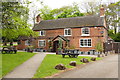
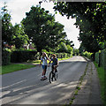
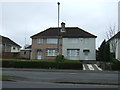
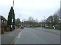
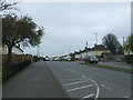
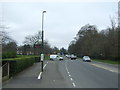
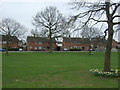
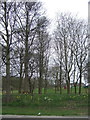
63 photos from this area
Area Information
Key information about the NG8 4PN including its size, population, and administrative classification.
- Area Type
- Postcode
- Area Size
- 2.0 hectares
- Population
- 1549
- Population Density
- 4620 people/km²
House Prices in NG8 4PN
17
Properties
£114,200
Average Sold Price
£45,500
Lowest Price
£172,500
Highest Price
Showing 17 properties
| Address | Type | Beds | Baths | Last Sale Price | Last Sale Date | |
|---|---|---|---|---|---|---|
| 80 Bracebridge Drive, Nottingham, NG8 4PN | house | - | - | £172,500 | Mar 2021 | |
| 78 Bracebridge Drive, Nottingham, NG8 4PN | Semi-detached | 3 | 1 | £160,000 | Oct 2020 | |
| 76 Bracebridge Drive, Nottingham, NG8 4PN | Semi-detached | 3 | - | £118,000 | Jul 2018 | |
| 74 Bracebridge Drive, Nottingham, NG8 4PN | house | - | - | £75,000 | Jan 2011 | |
| 66 Bracebridge Drive, Nottingham, NG8 4PN | house | - | - | £45,500 | Jul 2001 | |
| 82 Bracebridge Drive, Nottingham, NG8 4PN | Terraced | 3 | 1 | - | - | |
| The Pelican, Bracebridge Drive, Nottingham, NG8 4PN | restaurant_cafe | - | - | - | - | |
| 62 Bracebridge Drive, Nottingham, NG8 4PN | house | - | - | - | - | |
| 68 Bracebridge Drive, Nottingham, NG8 4PN | Terraced | - | - | - | - | |
| 58 Bracebridge Drive, Nottingham, NG8 4PN | house | - | - | - | - |
Page 1 of 2
Energy Efficiency in NG8 4PN
Amenities
Schools
| Rank | School | Type | Entry gender | Ages |
|---|
Explore more schools in this area
Go to Schools tabDemographics
Household Size
One person
most common
Accommodation Type
Houses
most common
Tenure
37
majority
Ethnic Group
White
most common
Religion
N/A
most common
Household Composition
N/A
most common
Age
47
median
Adults (30-64 years)
most common
Household Deprivation
N/A
with no deprivation
NS-SEC
12
in Lower managerial occupations
Explore more demographic insights in this area
Go to Demographics tabPlanning
Planning Constraints
- Flood RiskPremium
- Ramsar Wetland SitesPremium
- Area of Outstanding Natural BeautyPremium
- Protected Nature ReservePremium
- Protected WoodlandPremium