Area Overview for NG8 4HT
Photos of NG8 4HT
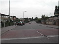
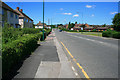
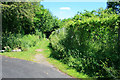
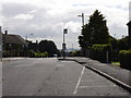
37 photos from this area
Area Information
Key information about the NG8 4HT including its size, population, and administrative classification.
- Area Type
- Postcode
- Area Size
- 9219 m²
- Population
- 1697
- Population Density
- 2711 people/km²
House Prices in NG8 4HT
24
Properties
£101,082
Average Sold Price
£40,000
Lowest Price
£180,000
Highest Price
Showing 24 properties
| Address | Type | Beds | Baths | Last Sale Price | Last Sale Date | |
|---|---|---|---|---|---|---|
| 72 Tremayne Road, Nottingham, NG8 4HT | Semi-detached | 3 | 1 | £180,000 | Aug 2024 | |
| 38 Tremayne Road, Nottingham, NG8 4HT | house | 3 | - | £155,700 | Mar 2021 | |
| 62 Tremayne Road, Nottingham, NG8 4HT | house | 3 | - | £157,000 | Mar 2021 | |
| 36 Tremayne Road, Nottingham, NG8 4HT | Semi-detached | 3 | 1 | £96,000 | Aug 2016 | |
| 60 Tremayne Road, Nottingham, NG8 4HT | house | 3 | - | £96,800 | Oct 2015 | |
| 70 Tremayne Road, Nottingham, NG8 4HT | Semi-detached | 3 | 1 | £91,900 | Apr 2013 | |
| 74 Tremayne Road, Nottingham, NG8 4HT | house | 3 | - | £70,000 | May 2011 | |
| 52 Tremayne Road, Nottingham, NG8 4HT | house | - | - | £91,000 | Oct 2007 | |
| 28 Tremayne Road, Nottingham, NG8 4HT | house | - | - | £79,000 | Sep 2003 | |
| 40 Tremayne Road, Nottingham, NG8 4HT | Semi-detached | - | - | £54,500 | Feb 2002 |
Page 1 of 3
Energy Efficiency in NG8 4HT
Amenities
Schools
| Rank | School | Type | Entry gender | Ages |
|---|
Explore more schools in this area
Go to Schools tabDemographics
Household Size
One person
most common
Accommodation Type
Houses
most common
Tenure
49
majority
Ethnic Group
White
most common
Religion
N/A
most common
Household Composition
N/A
most common
Age
47
median
Adults (30-64 years)
most common
Household Deprivation
N/A
with no deprivation
NS-SEC
19
in Lower managerial occupations
Explore more demographic insights in this area
Go to Demographics tabPlanning
Planning Constraints
- Flood RiskPremium
- Ramsar Wetland SitesPremium
- Area of Outstanding Natural BeautyPremium
- Protected Nature ReservePremium
- Protected WoodlandPremium