Area Overview for NG8 2NP
Photos of NG8 2NP
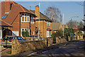

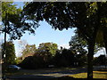
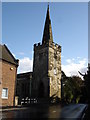
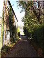
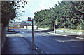
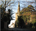
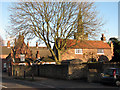
100 photos from this area
Area Information
Key information about the NG8 2NP including its size, population, and administrative classification.
- Area Type
- Postcode
- Area Size
- 11.5 hectares
- Population
- 1720
- Population Density
- 1408 people/km²
House Prices in NG8 2NP
19
Properties
£535,792
Average Sold Price
£193,500
Lowest Price
£1,900,000
Highest Price
Showing 19 properties
| Address | Type | Beds | Baths | Last Sale Price | Last Sale Date | |
|---|---|---|---|---|---|---|
| 104 Parkside, Nottingham, NG8 2NP | Retail | 5 | 3 | £1,900,000 | Nov 2022 | |
| 136 Parkside, Nottingham, NG8 2NP | Detached | 4 | 1 | £596,000 | Oct 2018 | |
| 126 Parkside, Nottingham, NG8 2NP | Detached | 4 | 1 | £610,000 | Feb 2018 | |
| 108A Parkside, Nottingham, NG8 2NP | Bungalow | 3 | 1 | £495,000 | Dec 2017 | |
| 110 Parkside, Nottingham, NG8 2NP | Detached | 3 | - | £425,000 | Nov 2016 | |
| 114 Parkside, Nottingham, NG8 2NP | house | - | - | £410,000 | Mar 2016 | |
| 132A Parkside, Nottingham, NG8 2NP | Bungalow | - | - | £220,000 | Oct 2014 | |
| 138 Parkside, Nottingham, NG8 2NP | house | - | - | £345,000 | Jul 2010 | |
| 118 Parkside, Nottingham, NG8 2NP | Detached | - | - | £480,000 | Jun 2005 | |
| 122 Parkside, Nottingham, NG8 2NP | Detached | - | - | £555,000 | Dec 2004 |
Page 1 of 2
Energy Efficiency in NG8 2NP
Amenities
Schools
| Rank | School | Type | Entry gender | Ages |
|---|
Explore more schools in this area
Go to Schools tabDemographics
Household Size
Family (3-5 people)
most common
Accommodation Type
Houses
most common
Tenure
89
majority
Ethnic Group
White
most common
Religion
N/A
most common
Household Composition
N/A
most common
Age
47
median
Adults (30-64 years)
most common
Household Deprivation
N/A
with no deprivation
NS-SEC
53
in Lower managerial occupations
Explore more demographic insights in this area
Go to Demographics tabPlanning
Planning Constraints
- Flood RiskPremium
- Ramsar Wetland SitesPremium
- Area of Outstanding Natural BeautyPremium
- Protected Nature ReservePremium
- Protected WoodlandPremium